Categories
Shopping cart (0 items € 0)
Advanced search

Cartography & Exploration / Middle East & Islamic World

A superb set of two lavishly illustrated descriptions of Arabia and the Middle East
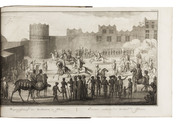
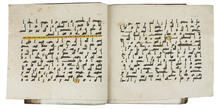
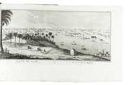
NIEBUHR, Carsten. Beschryving van Arabie.
Amsterdam, Steven Jacobus Baalde; Utrecht, Johannes van Schoonhoven & comp. (colophon: printed by Johan Joseph Besseling, Utrecht), 1774. With engraved title-page and 25 engraved plates, including 7 folding showing 1 view of military exercises, 2 Kufic inscriptions (coloured by hand) and 4 maps. The unnumbered map of Yemen (plate size 58.5 x 39 cm) is coloured by hand in outline.
With: (2) NIEBUHR, Carsten. Reize naar Arabië en andere omliggende landen.
Amsterdam, Steven Jacobus Baalde; Utrecht, Johannes van Schoonhoven & comp. (colophons: printed by Johan Joseph Besseling, Utrecht), 1776-1780. With 2 engraved title-pages and 125 engraved plates (38 folding). 2 works in 3 volumes. Large 4to (28.5 x 22.5 cm). Contemporary sprinkled and polished half calf. Untrimmed. [6], XXXXI, [1], 408, [14]; [2], VIII, [6], 484, [2]; [16], 455, [1] pp. Full description
€ 10,000
Order Inquire Terms of sale

Important contribution to the study of the Middle East

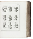
NIEBUHR, Carsten. Voyage en Arabie & en d'autres pays circonvoisins. Tome premier[- second]. Traduit de l'Allemand.
Amsterdam, Steven Jacobus Baalde; Utrecht, Barthelemy Wild (colophon: printed by Joh. Jos. Besseling, Utrecht, 1775), 1775-1780. 2 volumes. 4to. With 2 engraved integral title-pages, 124 engraved plates (many folding) and a folding map of Yemen (in partial colour). Contemporary gold-tooled calf. VIII, [6], 409, [1], [1 blank]; VI, [10], 389, [1] pp. Full description
€ 6,000
Order Inquire Terms of sale

Account of the first scientific expedition to the Middle East, Egypt, Persia and India

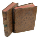
NIEBUHR, Carsten. Reize naar Arabië en andere omliggende landen.
Amsterdam, S.J. Baalde; Utrecht, J. van Schoonhoven and company (vol. 1) and Bartholomeus Wild (vol. 2) (colophons: Utrecht, printed by J.J. Besseling), 1776-1780. 2 volumes. 4to. With 2 engraved title-pages, each with a vignette, 31 engraved maps and plans and 94 other engraved plates. 19th-century half calf. Untrimmed. VIII, [6], 484, [2]; [16], 455, [1] pp. Full description
€ 6,000
Order Inquire Terms of sale

First Dutch edition of Niebuhr's detailed and extensively illustrated description of his travels
in Arabia and surrounding regions

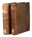
NIEBUHR, Carsten. Reize naar Arabië en andere omliggende landen.
Amsterdam, S.J. Baalde; Utrecht, J. van Schoonhoven & Comp. (vol. 1) and Bartholomeus Wild (vol. 2) (colophons: printed in Utrecht by Johan Joseph Besseling), 1776-1780. 2 volumes. 4to (27.5 x 22 cm). With 2 engraved title-pages, each with the same vignette, 35 maps and plans (9 folding and the large map of Yemen coloured by hand in red and green outlines), 21 views (12 folding) and 69 other illustrations (19 folding) of people, sculptures and examples of ancient script, engraved by C. Philips, Th. and C.H. Koning, C.J. de Huyser, C.F. Fritsch, C. Brouwer and others. Half calf, sprinkled paper sides, gold-tooled spine with a red title label with gold lettering. VIII (I and III blank), [6], 484, [2]; [1], [1 blank], [1], [1 blank], [12], 455, [1] pp. Full description
€ 5,000
Order Inquire Terms of sale

Rare travel account

OPPENHEIM, Max von. Vom Mittelmeer zum Persischen Golf durch den Hauran, die Syrische Wüste und Mesopotamien.
Berlin, Dietrich Reimer, 1899-1900. 2 volumes. Large 8vo. With 2 (of 3) folding maps in pockets on the inside of the back board and numerous illustrations in the text and on photographic plates. Original illustrated green cloth. XV, [1], 334; [1], 434 pp. Full description
€ 8,500
Order Inquire Terms of sale

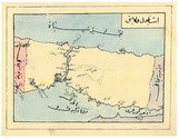
Ottoman manuscript atlas of the western (mostly European) parts of the Ottoman Empire, with 10 maps

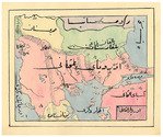
[OTTOMAN ATLAS - MANUSCRIPT]. [Atlas of the western Ottoman Empire].
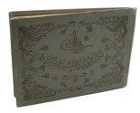
Ottoman Empire, ca. 1910. Oblong 4to (26.5 x 19.5 cm). 14 leaves with 10 pen-and-ink maps, hand coloured with watercolours. Tissue guards. Gold-stamped cloth with the tughra of Mehmed V (ruled 1908-18) on the front board (when reading right to left) and "Album" on the back board (the front when reading left to right), with an inscription below the tughra and the European numerals "16" and "2" flanking an ornament below the inscription, the whole framed by 4 large floral cornerpieces. Full description
€ 8,500
Order Inquire Terms of sale

Probably the first manual for the use of chronometers at sea

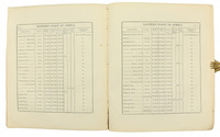
OWEN, William Fitzwilliam (ed.) & Richard OWEN. Tables of latitudes, and longitudes by chronometer, of places in the Atlantic and Indian Oceans; principally of the west and east coast of Africa, the coasts of Arabia, Madagascar. &c. resulting from the observations of H.M.S. Leven and Barracouta, in the years 1820 to 1826 inclusive, ... To which is prefixed an essay on the management and use of chronometers ...
London, George Duckworth and William Ireland, 1827. 4to. Contemporary blue boards for the Danish Navy Library, later backed with cloth. [2], 33, [3], 16, [36], 8 pp Full description
€ 2,500
Order Inquire Terms of sale

Warmly inscribed by the author

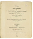
PALGRAVE, William Gifford. Personal narrative of a year's journey through Central and Eastern Arabia (1862-63).
London and New York, Macmillan and Co., 1871. 8vo (ca. 13 x 19 cm). With a linen-backed folding map and 3 extending plans. Contemporary half morocco with maroon cloth over boards, gilt, front board stamped with the owner's initials "G.W.T.", marbled endpapers. [2], VI, [4], 421, [1] pp. Full description
€ 2,500
Order Inquire Terms of sale

Traversing Qajar Persia with a manuscript guide

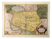
[PERSIA - TRAVEL GUIDE]. [Manuscript travel guide].
[Qajar Iran, ca. 1850s]. 8vo (12.5 x 22 cm). Persian manuscript on polished paper. Black nasta'liq script in 15 lines per page, ruled in green and blue, with rubricated chapter headings and marginal medallions. Contemporary limp leather and woven floral-patterned cloth. 26 ll. Full description
€ 8,500
Order Inquire Terms of sale
130 books found / Show all