Categories
Shopping cart (0 items € 0)
Advanced search

Middle East & Islamic World / Cartography & Exploration

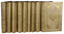
8 large illustrated volumes of the most important voyages from the 15th to the end of the 17th century

AA, Pieter van der (editor) and Johann Ludwig GOTTFRIED. De aanmerkenswaardigste en alomberoemde zee- en landreizen der Portugeezen, Spanjaarden, Engelsen en allerhande natiën: zoo van Fransen, Italiaanen, Deenen, Hoogh- en Nederduitsen als van veele andere volkeren. Voornaamenlyk ondernomen tot ontdekking van de Oost- en Westindiën, midsgaders andere verafgelegene gewesten des aardryks.
The Hague, widow of Engelbrecht Boucquet and sons; Leiden, Jan van der Deyster, and Boudewijn and Pieter van der Aa, 1727. 8 volumes. 1mo and folio. With 7 (of 8) engraved frontispieces (lacking that of volume 4), 4 engraved dedications, 117 engraved maps on 61 leaves, 7 engraved plates and 502 engravings in text. Further with 127 (of 128) title-pages (including a general title-page, a title-page to 7 (of 8) volumes, lacking that of volume 4, and 118 for the separate works). Volume 1-3 & 5-8: contemporary mottled calf, gold-tooled spine and board edges; volume 4: modern calf. Full description
€ 65,000
Order Inquire Terms of sale

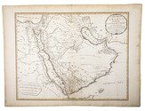
Highly detailed wall map of Asia and the Arabian peninsula, from the collection of the Governor of Ceylon

ARROWSMITH, Aaron. Asia.
London, Aaron Arrowsmith, 1 January 1801. Engraved wall map, hand coloured in outline, on 4 sheets joined as 2 (measuring 124 x 147 cm in total) on a scale of ca. 1:6,490,880, with an elaborately decorated cartouche at the head left, a dedication below ("To major James Rennell, Esqr. F.R.S. &c. &c.") and the name of the engraver at the foot right (George Allen). Mounted on cloth and divided into 32 sections. Contemporary slipcase, covered with marbled paper and a manuscript title-label on front. Full description
€ 7,500
Order Inquire Terms of sale

French mission to Mount Carmel, with a portrait of the Emir

ARVIEUX, Laurent d'; Gerard KUIPERS (transl.). Reis naar de legerplaats van den grooten Emir, en beschrijving, van de zeeden en gewoonten, der woestyn-bewoonende Arabieren ... Uit het Fransch vertaald en met aanteekeningen vermeerderd door G. Kuipers ...
Utrecht, Henricus van Otterloo, 1780. 8vo. With engraved title-page with a vignette by De Vries (a female figure reading from "H[eilige] Schriftuur" (Holy Scripture) with 4 putti and in the background a desert scene with tents, camels and dozens of mostly dark-skinned people, apparently representing nomads), 3 full-page engraved plates by Izaak de Wit Jansz., an engraved half-page illustration (unsigned), headpieces built up from rococo typographic ornaments and woodcut tailpieces. Contemporary half tree calf, gold-tooled spine with red morocco label, shell-marbled sides. [6], XL, 384, [16] pp. Full description
€ 2,500
Order Inquire Terms of sale

A French view on the Arabs in a Dutch translation

ARVIEUX, Laurent d'. Reis naar de legerplaats van den Grooten Emir, en beschrijving van de zeeden en gewoonten der woestijn-bewoonende Arabieren ... Tweede druk.
Dordrecht, A. Blussé & Zoon, 1802. 8vo. With 3 full-page engraved plates and 1 engraved illustration in text. Contemporary gold-tooled half calf, shell-marbled sides. [4], XL, 384, [16] pp. Full description
€ 1,350
Order Inquire Terms of sale

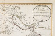
The geographical details of two outstanding maps of Arabia

BERGHAUS, Heinrich. Geographisches memoir zur erklärung und erlaüterung der Karte von Syrien. (no. 5. von Berghaus' Atlas von Asia).
Gotha, Justus Perthes, 1835. With an engraved map of Syria.
With: (2) BERGHAUS, Heinrich. Geo-hydrographisches memoir zur erklärung und erlaüterung der General-Karte von Arabia und dem Nil-Lande. (no. 6. von Berghaus' Atlas von Asia).
Gotha, Justus Perthes, 1835. 2 works in 1 volume. 4to. With a supplement to another article by Berghaus bound at the end: Supplement zur historisch-geographischen Beschreibung von Assam etc., with an engraved map. Modern half cloth. [4], 48; [4], 128; 179-182 pp. Full description
€ 2,500
Order Inquire Terms of sale

"The greatest and finest atlas ever published", with 610 maps, plans and views,
coloured by a contemporary hand

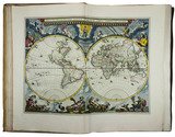
BLAEU, Joan. Grooten atlas, oft werelt-beschryving, in welcke t aerdryck, de zee, en hemel, wort vertoont en beschreven.
Amsterdam, Joan Blaeu, 1664-1665. 9 volumes. Imperial folio (55.5 × 36.5 cm). With 9 engraved title-pages, an engraved frontispiece and 610 engraved maps, views, plans, etc., mostly double-page (53.5 × 64 cm, plate size ca. 42 × 53 cm), 7 larger folding, a few single-page and a few smaller, many including additional inset maps, plans and views, and decorated with coats of arms, human & mythological figures, animals, produce, etc. With the engraved title-pages, frontispiece, other engravings (except for the compass rose and 2 inscriptions), woodcut devices on 4 title-pages and 1 woodcut initial coloured by a contemporary hand (the maps mostly in outline but with their decorations fully coloured) and some (mostly the engraved title-pages) with extensive use of gold. Contemporary gold-tooled vellum. Full description
€ 675,000
Order Inquire Terms of sale

First edition of the first printed ethnographic comparison of the world's people, typographically stunning

BOEMUS (BÖHM), Johannes. Omnium gentium mores leges et ritus ex multis clarrissimis rerum scriptoribus ... nuper collecti: & in libros tris distinctos Aphricam, Asiam, Europam, optime lector lege. [Half-title:] Repertorium librorum trium Ioannis Boemi de omnium gentium ritibus. Item index rerum scitu digniorum in eosdem. Cum privilegio Papali ac Imperiali M.D.XX.
[Colophon: Augsburg, Sigismund Grimm & Marcus Wirsung, July 1520]. Folio. With the letterpress half-title in an elaborate woodcut border with a trophy of arms, putti and mermen. 17th century vellum with 3 raised spine-bands. [6], LXXXI, [1] ll. Full description
€ 5,750
Order Inquire Terms of sale
118 books found / Show all