Categories
Shopping cart (0 items € 0)
Advanced search

Cartography & Exploration / Middle East & Islamic World

Instructions for Carsten Niebuhr's expedition to Arabia

MICHAELIS, Johann David. Recueil de questions, proposées à une société de savants, qui par ordre de Sa Majesté Danoise font le voyage de l'Arabie.
Amsterdam, S.J. Baalde; Utrecht, J. van Schoonhoven & comp., 1774. 4to. Set in roman type with incidental Greek, Hebrew, Arabic, Syriac and 1 word in Coptic. Near-contemporary tanned sheepskin, gold-tooled spine. [4], XLIV, 256, [16], 38, [2 blank] pp. Full description
€ 3,500
Order Inquire Terms of sale

Enormous panoramic Middle Eastern view with ruins, nearly 6 metres long

[VIEW - MIDDLE EAST]. [Mountainous landscape with Middle Eastern and classical Roman ruins, 6 shepherds with their flocks, several figures riding dromedaries and one riding a donkey, (date?) palms, lakes, etc.].
[Palestine?, ca. 1910?]. An enormous panoramic view drawn in coloured gouaches on a single, continuous roll of paper (70 x 583 cm), the drawing running to the edges of the paper. Full description
€ 35,000
Order Inquire Terms of sale

Two British voyages to the Middle East and the Moghul Empire

MILDENHALL, John, John CARTWRIGHT and [Samuel PURCHAS (editor)]. Oost-Indise voyagien van Johan Mildenhal en Johan Cartwright; onder veel avontuuren en opmerkelyke waarnemingen, (in de jaren 1599 en 1606) te water en te lande, gedaan na de landen van Persien en den Grooten Mogol.
Leiden, Pieter van der Aa, 1706. Folio. With an engraving on the title-page by Jan Goeree, 2 engraved illustrations in text and a woodcut tailpiece. Modern decorated cloth, dark blue title-labels. 10 ll. Full description
€ 750
Order Inquire Terms of sale

Excellent, attractively coloured large map of the Ottoman Empire at its height

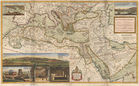
MOLL, Herman. The Turkish empire in Europe, Asia and Africa, divided into all its governments, together with the other territories that are tributary to it, as also the dominions of the Emperor of Marocco.
London, Herman Moll, John Bowles, Thomas Bowles & John King, ca. 1730. A large engraved map in two sheets (61 x 101 cm as assembled) at a scale of about 1:7,100,000, with 3 insets containing 6 topographic and architectural views. Coloured. Full description
€ 8,500
Order Inquire Terms of sale

First complete edition of Cosmas's Christiana topographia describing his travels
in the Red Sea and the Arabian Gulf

MONTFAUCON, Bernard de (editor). Collectio nova patrum et scriptorum Graecorum, Eusebii Caesariensis, Athanasii, & Cosmae Aegyptii.
Paris, Claudius Rigaud, 1707. 2 volumes. Folio. With 4 engraved plates, and 3 woodcut illustrations in the text. Each volume with an engraved headpiece, the first incorporating the coat of arms of Pope Clement XI, and the second that of Jean-Paul Bignon. Contemporary calf, richly gold-tooled spine and binding edges. [14], XL, [1], [1 blank], 732, [26], [2 blank]; [16], LXVIII, 112, [2], I-XXIV, 113-593, [26], [1 blank] pp. Full description
€ 25,000
Order Inquire Terms of sale

For official use only: Royal Navy wartime handbook on Iraq and the Persian Gulf

NAVAL INTELLIGENCE DIVISION. [MASON, Kenneth, a.o.]. Iraq and the Persian Gulf. September 1944. B.R. 524 (restricted) geographical handbook series for official use only.
[Oxford,] Naval Intelligence division, 1944. 8vo. With numerous diagrams, reproductions of photographs and (folding) maps, including a loose map in the pocket at the back. Publisher's green cloth. 682 pp. Full description
€ 3,500
Order Inquire Terms of sale

Eyewitness account of the horrors of the Napoleonic campaigns:
Germany, Poland, Moldavia & Turkey in aquatint

NEALE, Adam. Travels through some parts of Germany, Poland, Moldavia, and Turkey.
London, (back of title-page: printed by A. Straham), 1818. 4to. With 15 hand-coloured aquatints on 11 plates by I. Clark after drawings by author. 19th-century half morocco (Root bookbinders, London), richly gold-tooled spine. XIII, 295 pp. Full description
€ 1,950
Order Inquire Terms of sale

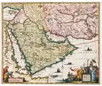
Niebuhr's description of Arabia: an important contribution to the study of the Middle East

NIEBUHR, Carsten. Beschrijving van Arabie, uit eigene waarnemingen en in 't land zelf verzamelde narigten opgesteld door Carsten Neibuhr. Uit het Hoogduits vertaald, en vermeerderd met een volledig register van 't geheele werk.
Amsterdam and Utrecht, S.J. BAalde and J. van Schoonhoven & Comp., MDCCLXXIV [= 1774]. 2 works in one volume. 4to. With engraved title-page, 24 (partly folding, a few coloured) maps and views, including a long folding map of the Red Sea, a folding genealogical table of the rulers of Sana, and the large map of Yemen (coloured in outline). With some parts (some sentences) of the text printed in Arabic script.
With: (2) MICHAËLIS, Johann David [transl. Jacob van EKERS]. Vragen aan een gezelschap van geleerde mannen, die op bevel zynder majesteit des konings van Denemarken naar Arabie reizen. Voorgesteld door den hooggeleerden en wydberoemden heer Johann David Michaëlis. Koninglyken Grootbrittanischen en keurvorstlyken Brunswyk- Lunenburgschen hofraad, hoogleeraar in de wysbegeerte te Gottingen, en bestierder van de societeit der wetenschappen aldaar. Waarby gevoegd is, beoordeling van Niebuhrs beschryving van Arabie door den zelfden schryver, getrokken uit deszelfs orientalische en exegetische bibliotheek , IV. deel. In 't Neerduitsch vertaald en uitgegeven door Jacob van Ekers, bedienaar des goddelyken woords te Medenblik.
Amsterdam and Utrecht, S.J. Baalde and J. van Schoonhoven and Comp., MDCCLXXIV [=1774].
Contemporary half calf marbled sides, gold-tooled spine, red and black spine labels with the two titles lettered in gold. [6], XXXXI, [1], 408, [14]; [2 blank] XLVI, 270, [2] pp. Full description
€ 2,800
Order Inquire Terms of sale
130 books found / Show all