Categories
Shopping cart (0 items € 0)
Advanced search

Cartography & Exploration / Middle East & Islamic World

The first European crossing the Rub' al-Khali (Empty Quarter) of Arabia from east to the west

PHILBY, Harry St. John Bridger and Alfred Felix Landon BEESTON. Sheba's daughters beign a record of travel in southern Arabia. With an appendix on the rock inscriptions by A.F.L. Beeston.
London, Methuen & Co., [1939]. 4to. With photographic frontispiece, 46 photographic plates (1 of which double-page), 1 folding map of southern Arabia, and several photographic illustrations in the text. Contemporary light yellow cloth with giltstamped title and ornament to the spine. XIX, [1 blank], 485, [1] pp. Full description
€ 350
Order Inquire Terms of sale

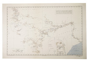
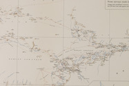
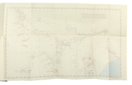
Travelling in the Hadramaut: the longest journey of Philby through southern Arabia

PHILBY, Harry St John Bridger. The land of Sheba (The Geographical Journal Vol. 92, no. 1).
[United Kingdom, The Royal Geographical Society], July 1938. 8vo. With 1 large folding coloured map, 1 smaller uncoloured folding map, and numerous photographs on 7 plates. Later half black cloth. 21, 107-132 pp. Full description
€ 300
Order Inquire Terms of sale

Only published edition of the original 1521 text of the navigation book of the great Ottoman admiral

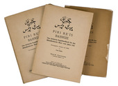
PIRI REIS (Paul KAHLE, ed.). Bahrije. Das türkische Segelhandbuch für das Mittelländische Meer vom Jahre 1521.
Berlin and Leipzig, Walter de Gruyter & Co., 1926-1927. 3 volumes. Large 8vo (26 x 18 cm). Volume 1 with 137 reproductions of manuscript pages of Ottoman Turkish text and maps and volume 2 with 4 plates. Publisher's original printed wrappers. [1], [1 blank], [2] pp. + 64 ll. + [4], [1 blank], [1] pp.; ll. 65-137; [1], [1 blank], XLVIII, 88 pp. Full description
€ 2,500
Order Inquire Terms of sale

An important source of knowledge of the Near East

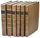
POCOCKE, Richard. Beschryving van het Oosten, en van eenige andere landen. Uit het Engelsch overgezet en met aantekeningen voorzien, door Ernst Willem Cramer.
Utrecht, Rotterdam and Amsterdam, G.T. en A. van Paddenburg, J. Bosch, R. Arrenberg, and M. de Bruyn, 1776-1786. 3 volumes (in 6 parts) bound as 6. 4to. With 205 folding engraved maps, plans, views and plates. Contemporary half calf. Full description
€ 12,000
Order Inquire Terms of sale

Augmented Dutch edition of Pocockes celebrated description of the Near and Middle East,
with 205 engraved plates

POCOCKE, Richard. Beschryving van het Oosten, en van eenige andere landen, ...
Utrecht, Gijsbert Tieme and Abraham van Paddenburg; Rotterdam, Jacobus Bosch and Reinier Arrenberg; Amsterdam, Martinus de Bruyn, 1776-1786. 3 volumes (in 6 parts) bound as 6. 4to. With 205 engraved folding plates (irregularly numbered I-CIII), including maps, plans, views and other illustrations, depicting temples, antiquities, plants, animals, etc. Contemporary half calf. XXXVI, 219, [1 blank], [11], 224-491, [1 blank]; [12], 262, [2 blank], VIII, [3], 268-376, 397-519, [1 blank]; VIII, 262, [2 blank], VIII, [3], 268-403, [1 blank]; [4], 115, [1], 124 pp. Full description
€ 15,000
Order Inquire Terms of sale

One of the earliest maps of Arabia, with unique contemporary illumination

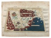
[MAP - ARABIAN PENINSULA]. PTOLEMAEUS, Claudius. [Jacobus ANGELUS, trans.; Nicolaus GERMANUS, ed.]. Sexta Asie Tabula.
Ulm, Lienhart Holle, 1482. Oblong 1mo (whole sheet: 41.5 by 57 cm). With a double-page woodcut map. Finely coloured by a contemporary hand, with near-contemporary manuscript vignette illustrations of an Ababeel bird, Makkah (Mecca) and the Kaaba in pen and wash highlighted in gold. Full description
€ 150,000
Order Inquire Terms of sale
130 books found / Show all