Categories
Shopping cart (0 items € 0)
Advanced search

Maritime History / Navigation

An important surveying voyage to the Pacific

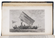
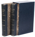
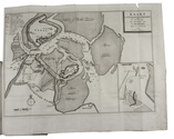
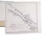
BELCHER, Edward. Narrative of a voyage round the world, performed in Her Majesty's ship Sulphur, during the years 1836-1842, including details of the naval operations in China, from Dec. 1840 to Nov. 1841.
London, Henry Colburn, 1843. 2 volumes. 8vo. With a folding map of the Canton river, folding map with the routes of the H.M.S. Sulphur, large world chart also showing the route of the Sulphur, 19 steel-engraved views and several illustrations in text. Gold-tooled blue sheepskin, shell-marbled sides. Rebacked. In modern slipcase. XXII, 387; VI, 474 pp. Full description
€ 2,950
Order Inquire Terms of sale

Wonderful and very rare nautical atlas for the Mediterranean

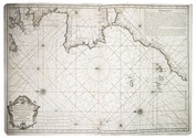
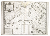
BERTHELOT, François. [Nautical atlas of the Mediterranean Sea].
Marseille, "se vend chez Benoît", 1720-1730. Large folio (40 x 55 cm). With 4 double-page engraved maps, with the first half of the first map as the front paste-down and the second half of the last map as the back paste-down. Contemporary vellum-backed boards, reinforced with light brown leather at the head and foot of the spine. 4 nautical maps on [8] pp. Full description
€ 8,500
Order Inquire Terms of sale

Winds and the weather in the coast of India and the Arabian and Persian Gulf:
first edition of a rare meteorological work

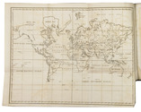
CAPPER, James. Observations on the winds and monsoons; illustrated with a chart and accompanied with notes, geographical and meteorological.
London, Charles Whittingham, 1801 4to. With 1 folding engraved map of the world depicting all the world-wide seas and waters and several tables printed within the text. Later half calf. XXVIII, 29-234 pp. Full description
€ 2,950
Order Inquire Terms of sale

Navigation and astronomical research in present-day Canada

CHABERT, Joseph Bernard. Voyage fait par ordre du Roi en 1750 et 1751, dans l'Amérique septentrionale, pour rectifier les cartes des côtes de l'Acadie, de l'Isle Royale & de l'Isle de Terre-Neuve; et pour en fixer les principaux points par des observations astronomiques.
Paris, Imprimerie Royale, 1753. 4to. With an engraved printer's vignette on the title-page, an engraved headpiece at the beginning of the first chapter, 6 folding engraved maps, a folding engraved plate showing geometrical figures, and a large folding table with calculations for the position of the sun and the moon. Contemporary gold-tooled red morocco. [2], VIII, 288, [10] pp. Full description
€ 12,500
Order Inquire Terms of sale

Europe fortified: the fortifications of Marolois, Stevin and Vauban, beautifully mapped,
together with an atlas of the coasts of France, also with fortifications

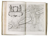
FER, Nicolas de. Les forces de l' Europe, ou description des principales villes; avec leurs fortifications. . . .
Paris, "chez l'auteur" [=Nicolas de Fer, a false imprint], 1695-1696 [printed in Amsterdam, for Pieter Mortier, 1695-ca. 1702]. 10 parts in 1 volume. With 234 beautifully engraved plates (a few folding) with 366 maps and views of fortified cities.
With: (2) FER, Nicolas de. Costes de France, sur l' ocean & sur la Mer Mediterranée &c. avec leurs fortifications. . . .
Paris, "Nicolas de Fer" [a false imprint], 1695. [printed in Amsterdam, for Pieter Mortier]. With engraved title-page and 40 engraved plates (including 2 folding). 2 works in 12 parts or volumes, bound as 1 volume. Oblong 1mo (30×37 cm). Contemporary tanned sheepskin, gold-tooled spine. Full description
€ 17,500
Order Inquire Terms of sale

A standard navigational directory for the Indian Archipelago

FINDLAY, Alexander George. A directory for the navigation of the Indian archipelago and the coast of China, from the Straits of Malacca and Sunda, and the passages east of Java, to Canton, Shanghai, the Yellow Sea, and Korea. With the descriptions of the winds, monsoons, and currents, and general instructions for the various channels, harbours, etc. Third edition.
London, Richard Holmes Laurie, 1889. Royal 8vo. With 11 folding maps and charts. Original publishers blindstamped cloth, lettered in gold. XLVIII, IV, 1478; [2], 8 pp. Full description
€ 2,500
Order Inquire Terms of sale

Testing chronometers by Harrison's leading French rival

FLEURIEU, Charles Pierre Claret, Count d'Eveux de. Voyage fait par ordre du Roi en 1768 et 1769, à différentes parties du monde, pour éprouver en mer les horloges marines inventées par M. Ferdinand Berthoud. Première[-seconde] partie, ...
Paris, Imprimerie Royale, 1773. 2 volumes. Large 4to (27 x 20.5 cm). With 5 numbered folding engraved plates in volume 1 (4 maps of the Atlantic Ocean, the Canaries, the Azores, etc., and 1 plate with topographic diagrams), 1 folding engraved plate with geometrical figures illustrating the determination of latitude[!], and 5 folding letterpress tables in volume 2. Contemporary gold-tooled mottled calf. [2], LXXIX, [1 blank], 803, [1 blank]; [2], 622, XL, [2 blank] pp. Full description
€ 9,500
Order Inquire Terms of sale
77 books found / Show all