Categories
Shopping cart (0 items € 0)
Advanced search

Cartography & Exploration / Atlases, Charts, Maps & Globes

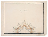
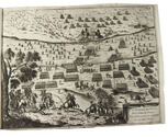
Three fortification plans, including a large coloured plan of the fortifications of Neuf-Brisach
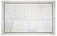
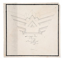
[DRAWING - FORTIFICATION]. GENNEP, T.P. van. [Three fortification plans].
[Raamsdonk], 1798. 3 manuscript fortification plans (measuring (ad 1) 58 x 93 cm, (ad 2) 24.5 x 24.5 cm (ad 3) 29.5 x 37 cm) on paper. All signed: T.P. van Gennep, 1798; and one: Raamsdonk, 29 January 1798. Full description
€ 950
Order Inquire Terms of sale

A general in the Spanish army on the battles and sieges in Flanders 1601-1609,
during the Dutch war for independence, with 29 folding maps and plans

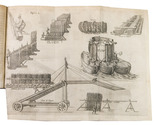
GIUSTINIANO, Pompeo. Delle guerre di Flandra libri VI. ... Posti in luce da Gioseppe Gamurini ...
Antwerp, J. Trognesio, 1609. 4to. With engraved architectural title-page and 29 folding engraved maps and plans of sieges and fortifications. White sheepskin (ca. 1700 or possibly later). [4], 329, [1 blank], [15], [3 blank] pp. Full description
€ 2,950
Order Inquire Terms of sale

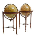
A pair of striking Victorian library globes by map-maker George Frederick Cruchley

[GLOBES - TERRESTRIAL & CELESTIAL]. CRUCHLEY, George Frederick. Cruchley's new terrestrial globe from the most recent and best authorities, exhibiting the discoveries in equatorial Africa, North Pole, and the new settlements and divisions in Australia, New Zealand, California, Texas &c.
London, George Frederick Cruchley, [ca. 1850].
With: CRUCHLEY, George Frederick. Cruchleys new celestial globe on which is accurately laid down the whole of the stars and nebule contained in the astronomical catalogue of the Reverend Mr. Wollaston F.R.S. Also from the authorities Flamstead, De la Caille, Hevellus, Bradley, Herschel, Maskelyne, &c. and the limits of each constellation determined by a boundary line.
London, George Frederick Cruchley, [ca. 1850].
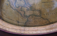
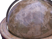
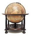
A matching pair of terrestrial and celestial globes (53 cm diameter) each made a hollow paper-marché core (2 hemispheres, joined at the equator), covered with a layer of plaster and 12 hand-coloured, engraved gores, showing the terrestrial geography and celestial bodies in great detail. Each globe mounted in a mahogany tripod stand on small wheels. With a compass (diameter: 25 cm) at the base of each stand; graduated brass meridian ring and engraved graduated horizontal rings (paper pasted on the mahogany frame) showing the months of the year, the zodiac signs and wind directions. Full description
€ 97,500
Order Inquire Terms of sale

A pair of extremely rare Valk table globes

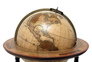
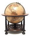
[GLOBES - TERRESTRIAL & CELESTIAL]. VALK, Gerard and Leonard. [Terrestrial globe:] Cosmotheore, caelesti nostro globo, par, et plane novus, hic terrestris ut existeret, certo scias, errore veterum sublato, non tantum utriusque orbis, longitudines ac latitudines, par reiterates neotericorum observationes, hicce esse restitutas, sed et nullum typis emendatiorem prodiisse, hoc igitur novissimô tam diu fruere, donec sub majori forma, meô aere alios excudam Gerardus Valk calcographus, Amsterdami, A[nn]o 17[50] cum privilegio.
Amsterdam, [Maria Schenk, widow of Leonard Valk], 17[50].
And: [Celestial globe:] Uranographia, caelum omne hie complectens, illa pro ut aucta, et ad annum 1700 competum, magno ab hevelio, correcta est, ita, ejus ex prototypis, sua noviter haec ectypa, veris astronomiae cultoribus, exhibit et consecrate, Ger. et Leon. Valk, Amstelaedamenses.
Amsterdam, Gerard and Leonard Valk, [ca. 1711]. Full description
€ 275,000
Order Inquire Terms of sale

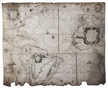
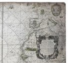
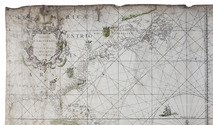
Goos' West-Indische paskaert in its very rare first state: a monumental nautical chart of the Atlantic Ocean in Mercator projection on vellum, used by the Dutch West Indian Company (WIC)

GOOS, Pieter. West-Indische Paskaert waer in de graden der breedde over wederzijden van de middellijn wassende so vergrooten dat die geproportioneert sijn tegen hunne nevenstaende graden de lengde. Vertonende behalve[n] Europaes zuydelijcste alle de zeekusten van Africa en America begrepen in 't Octroy bij de H.M.H. Staten Generael der vereenichde Nederl. verleent aende Generale West Indische Compagnie. Mitsgaders die van Peru en Chili inde groote Zuyd-Zee.
Amsterdam, Pieter Goos, [ca. 1660]. Printed on vellum (ca. 80 x 98 cm) from one large copperplate engraving, partly coloured by a contemporary hand. Full description
€ 185,000
Order Inquire Terms of sale

Italian fortification atlas of the Low Countries

GUALDO PRIORATO, Galeazzo. Teatro del Belgio ò sia descritione delle diecisette provincie del medesimo; con le piante delle città, e fortezze principali; da chi al presente possesse; come, in qual modo, & in qual tempo acquistate.
Vienna, Michael Thurnmayer, 1673. Folio. With engraved frontispiece with the coat-of-arms of all Seventeen Provinces, engraved military scene on the title-page, folding engraved map of the Low Countries, 2 folding engraved views of a sea-battle and an army crossing the Rhine, and 120 double-page engraved fortification plans. Contemporary mottled sheepskin, gold-tooled spine. [14], 148, [6] pp. text Full description
€ 5,000
Order Inquire Terms of sale

Hearne's expedition to the Arctic in a rare Dutch edition

HEARNE, Samuel and Johann Reinhold FORSTER (editor). Landreis van 't Prins van Wallis Fort aan Hudson Baai, naar den Noorder-Oceaan.
The Hague, J.C. Leeuwenstijn, 1798. 2 volumes. 8vo. With folding map, hand-coloured in outline (41.5×50.5 cm), a folding map of the Coppermine River, and 2 folding views, all engraved and etched. Contemporary half sheepskin, gold-tooled spine. 16, 247, [1 blank]; [4], 289, [1] pp. Full description
€ 2,500
Order Inquire Terms of sale

Large chart of European countries and their royal or noble families

[HERALDIC CHART - EUROPE]. SPECHT, Caspar. Historische en geographische tafel om te leren een kort begrip vande landen en staaten in Europa haar grootheyd, besitting en alles dat tot onderricht der liefhebbers van de landbeschryvinge dienen kan.
Amsterdam, Reinier and Joshua Ottens, [before 1750]. Engraved chart (47.5 x 57 cm) printed on a single sheet of paper (51.5 x 64 cm), coloured by hand, including several coats of arms. Full description
€ 250
Order Inquire Terms of sale
148 books found / Show all