John Crawfurd's sequel to his History of the Indian Archipelago
CRAWFURD, John.
A descriptive dictionary of the Indian Islands & adjacent countries.
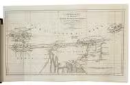
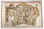
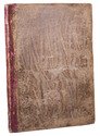
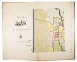
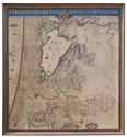
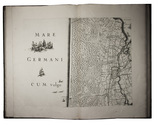
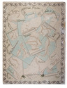
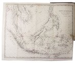
London, Bradbury & Evans, 1856. 8vo. With a folding engraved map of parts of the East Indies and Southeast Asia, with title "Asiatic Archipelago". Original publisher's blind-blocked brown cloth, title in gold on spine. [4], 459, [1 blank] pp. Full description
€ 2,750
London, Bradbury & Evans, 1856. 8vo. With a folding engraved map of parts of the East Indies and Southeast Asia, with title "Asiatic Archipelago". Original publisher's blind-blocked brown cloth, title in gold on spine. [4], 459, [1 blank] pp. Full description