Categories
Shopping cart (0 items € 0)
Advanced search

Cartography & Exploration / Atlases, Charts, Maps & Globes

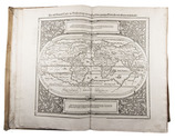
Most extensive edition of a monumental, extensively illustrated description of the world

MÜNSTER, Sebastian. Cosmographia, das ist: Beschreibung der gantzen Welt, ...
Basel, heirs of Sebastian Henricpetri, 1628. Folio (38 x 24.5 cm). With engraved title-page, letterpress title-page printed in red and black with woodcut portrait of Münster on the back, 26 numbered double-page woodcut maps on inserted bifolia, 72 double-page woodcut maps, plans and views on integral leaves, and about 1500 woodcut illustrations in the text (including repeats) showing maps, plans, views, plants, animals, monsters, etc. Contemporary vellum. [24], “1752” [=1748] , [12] pp. Full description
€ 48,000
Order Inquire Terms of sale

For official use only: Royal Navy wartime handbook on Iraq and the Persian Gulf

NAVAL INTELLIGENCE DIVISION. [MASON, Kenneth, a.o.]. Iraq and the Persian Gulf. September 1944. B.R. 524 (restricted) geographical handbook series for official use only.
[Oxford,] Naval Intelligence division, 1944. 8vo. With numerous diagrams, reproductions of photographs and (folding) maps, including a loose map in the pocket at the back. Publisher's green cloth. 682 pp. Full description
€ 3,500
Order Inquire Terms of sale

The VOC in 17th-century China

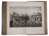
NIEUHOF, Johan. Het gezantschap der Neêrlandtsche Oost-Indische Compagnie, aan den grooten Tartarischen Cham, den tegenwoordigen keizer van China...
Amsterdam, Jacob van Meurs, 1670. Folio. With engraved title-page, letterpress title-page printed in red and black, full-page engraved portrait of the author, 1 large folding engraved map of China, 34 double-page engraved plates and views, 110 half-page engraved illustrations in text. Contemporary blind-tooled vellum. [8], 208, 258, [10] pp. Full description
€ 12,500
Order Inquire Terms of sale

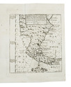
Voyage to the Strait of Le Maire and first detailed exploration of the region,
with an engraved folding map, and types made famous by Ibarra in Madrid

NODAL, Bartholome Garcia de & Gonzalo. Relacion del viage, que por orden de su magestad, y acuerdo de el real consejo de Indias ...
Including: ECHELEVAR, D. Manuel de, J.M. y J. Instruccion exacta, y util de las derrotas, y navegaciones ...
Cadiz, Don Manuel Espinosa de los Monteros, Impressor de la Real Marina, [1766?-1769]. 4to. With a folding map of the Strait of Magellan drawn and engraved by D.M. de Rueda, dated 1769. 2 parts in 1 volume. 4to. Contemporary limp sheepskin parchment by the Cadiz printing office's own bindery. [18], [2 blank], "162" [= 164], [2], [2 blank]; 41, [2], [1 blank] pp. Full description
€ 18,000
Order Inquire Terms of sale

Dutch translation of Elgin's mission to China and Japan

OLIPHANT, Laurence. De zending van graaf van Elgin naar China en Japan in 1857, 1858, 1859.
Utrecht, Nolet and son, [1860]. 2 volumes. 8vo. With 5 full-page chromolithographed plates, 3 lithographed maps (2 folding), some letterpress tables in text. Contemporary blue calf, purple textured cloth sides. XII, 382, [6]; [4], 361, [1] pp. Full description
€ 2,750
Order Inquire Terms of sale

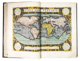
The most extensive 16th-century edition of the first great atlas, printed for the author by the Officina Plantiniana, with all maps highlighted in gold and coloured by a contemporary hand

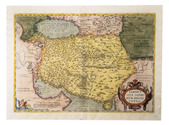
ORTELIUS, Abraham. Theatrum orbis terrarum.
Including: Parergon, sive veteris geograpiae [!] aliquot tabulae ...
[Antwerp, Ex Officina Plantiniana = Jan Moretus I, 1595].
With: Nomenclator Ptolemaicus; omnia locorum vocabula quae in tota Ptolemaei geographia occurrunt, continens: ad fidem Graeci codicis purgatus; & in ordinem non minus utilem quàm elegantem digestus.
Antwerp, Ex Officina Plantiniana [= Jan Moretus I], 1595. 3 parts in 1 volume. Large folio (44.5 x 29 cm). With an engraved general title page to the Theatrum without imprint, a divisional title page for the Parergon, with letterpress text in a woodcut architectural cartouche; and a title page for the Nomenclator with the imprint and woodcut publisher's device. Further with a full-page engraved portrait of Ortelius, 147 double-page engraved maps with letterpress text (numbered 1-115 in the Theatrum and lettered A-Z, a-i in the Parergon, the i misprinted as an h but corrected by scraping part away), about 40 woodcut images of the obverse and/or reverse of coins, some woodcut tailpieces, numerous woodcut decorated initials, and decorations built up from arabesque typographic ornaments. All maps, the engraved title page and portrait, the woodcut divisional title, publisher's device, decorations except for the coin illustrations, and all initials fully and brightly coloured by a contemporary hand. The engraved title page and portrait, the divisional title, publisher's device and all the maps also highlighted in gold. 17th-century gold-tooled brown calf, sewn on 6 supports with corresponding raised bands on the spine, gilt edges. [24] pp., 115 double-page maps with letterpress text; [7], [1 blank] pp., A-Z, a-i [= 32] double-page maps with letterpress text; 30, [5], [1 blank] pp. Full description
€ 550,000
Order Inquire Terms of sale

Topographical wall map of the Dutch (polder) district Vijfheerenlanden,
including the very rare engraved borders with coats of arms

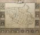
OTTENS, Reinier and Josua OTTENS. Nieuwe kaart van de Vyf Heeren landen gelegen tusschen den Dief en Zouwen dyk.
Amsterdam, Reinier and Josua Ottens, 1741. Engraved map on 4 sheets (85 x 98 cm as assembled), with an engraved title ("Kaart van de Vyf Heerenlanden") with the coat of arms of the water district at the head, and surrounded by 14 engraved coats of arms at the left, right and foot (measuring 122 x 134 cm in total). The map with the title and publisher at the foot left, together with a scale (ca. 1:19,000) and the name of the engraver at the right (Jan van Jagen). Framed. Full description
€ 6,500
Order Inquire Terms of sale

Topographical wall map of the Dutch (polder) district Vijfheerenlanden, coloured by a contemporary hand

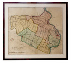
OTTENS, Reinier and Josua OTTENS. Nieuwe kaart van de Vyf Heeren landen gelegen tusschen den Dief en Zouwen dyk.
Amsterdam, Reinier and Josua Ottens, 1741. Engraved map on 4 sheets (85 x 98 cm as assembled), coloured by a contemporary hand. With the title and publisher at the foot left, together with a scale (ca. 1:19,000) and the name of the engraver at the right (Jan van Jagen). Framed. Full description
€ 6,000
Order Inquire Terms of sale

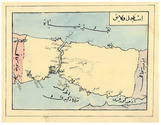
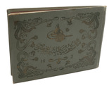
Ottoman manuscript atlas of the western (mostly European) parts of the Ottoman Empire, with 10 maps

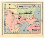
[OTTOMAN ATLAS - MANUSCRIPT]. [Atlas of the western Ottoman Empire].
Ottoman Empire, ca. 1910. Oblong 4to (26.5 x 19.5 cm). 14 leaves with 10 pen-and-ink maps, hand coloured with watercolours. Tissue guards. Gold-stamped cloth with the tughra of Mehmed V (ruled 1908-18) on the front board (when reading right to left) and "Album" on the back board (the front when reading left to right), with an inscription below the tughra and the European numerals "16" and "2" flanking an ornament below the inscription, the whole framed by 4 large floral cornerpieces. Full description
€ 8,500
Order Inquire Terms of sale
148 books found / Show all