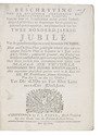
Two large wall maps of the Dutch provinces, from the library of Marco-Antonio III (1730-1800), Prince Borghese
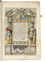
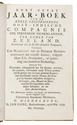
[MAPS - NETHERLANDS]. [LE ROUGE, George-Louis].
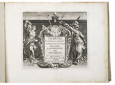
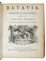
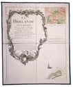
La Hollande en 12 feuilles dont les six premieres contiennent la Hollande ...
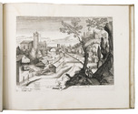
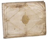
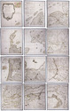
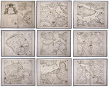
Paris, Jean A. Dezauche, successor of Delisle & Buache, 1790. Together ca. 230 x 155 cm. Engraved map, hand-coloured in outline. Printed on 12 sheets, each divided into 4 segments, numbered 1-48. The 12 sheets are mounted on contemporary linen and folded, the edges reinforced with blue ribbon.
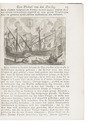
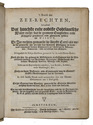
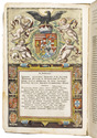
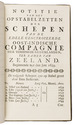
With: (2) LE ROUGE, George Louis. Topographie de la Zelande en 9 feuilles traduitte de l'Hollandois. [Second title:] Partie orientale de la Flandre Hollandoise, ...
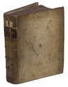
Paris, Jean A. Dezauche, 1790. Large engraved wall map, hand-coloured in outline, printed on 9 numbered sheets, each divided into 4 segments, numbered 1-36 (each sheet 48 x 56.5 cm); the 36 segments are mounted on contemporary linen, the edges reinforced with blue ribbon. Each map in contemporary box. Full description
€ 8,950
Paris, Jean A. Dezauche, successor of Delisle & Buache, 1790. Together ca. 230 x 155 cm. Engraved map, hand-coloured in outline. Printed on 12 sheets, each divided into 4 segments, numbered 1-48. The 12 sheets are mounted on contemporary linen and folded, the edges reinforced with blue ribbon.
With: (2) LE ROUGE, George Louis. Topographie de la Zelande en 9 feuilles traduitte de l'Hollandois. [Second title:] Partie orientale de la Flandre Hollandoise, ...
Paris, Jean A. Dezauche, 1790. Large engraved wall map, hand-coloured in outline, printed on 9 numbered sheets, each divided into 4 segments, numbered 1-36 (each sheet 48 x 56.5 cm); the 36 segments are mounted on contemporary linen, the edges reinforced with blue ribbon. Each map in contemporary box. Full description