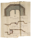
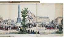
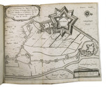
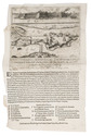
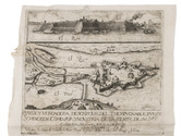
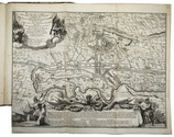
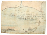
Brightly handcoloured contemporary manuscript plan showing a military camp
near Korbeek/Corbais, Belgium, during the Nine Years' War


[MAP - MILITARY - LOW COUNTRIES - KORBEEK].
Plan du campement de l'armée des alliees campée a Corbay depuis le 19 Juin au 7 Juliet l'an 1696.
[Belgium?, ca. 1696]. Manuscript plan on paper (38 x 48 cm) in ink and bright watercolour. With the title in a wreath at the head, a large panel at the foot with keys identifying the camps of the various troops, and two smaller panels at the head, with keys to the villages and other locations, and a general overview map. Full description
€ 2,000
[Belgium?, ca. 1696]. Manuscript plan on paper (38 x 48 cm) in ink and bright watercolour. With the title in a wreath at the head, a large panel at the foot with keys identifying the camps of the various troops, and two smaller panels at the head, with keys to the villages and other locations, and a general overview map. Full description