Categories
Shopping cart (0 items € 0)
Advanced search

Middle East & Islamic World / Turkey & Ottoman Empire

Field guide for officers during the Mesopotamian campaign (1914-1918), with a folding map

[MESOPOTAMIA]. [Indian Army General Staff]. For official use only. Field notes. Mesopotamia. General staff, India. February 1917.Including: Index to field notes, Mesopotamia, 1917.
Calcutta, Superintended government printing, 1917. Small 8vo. With 1 folding heliozincographed map of "Lower Mesopotamia", with some routes in red, and three folding letterpress tables. Original green cloth. [3], [1], 326(=325), [1]; [1], [1 blank], XX pp. Full description
€ 6,500
Order Inquire Terms of sale

Excellent, attractively coloured large map of the Ottoman Empire at its height

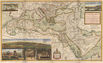
MOLL, Herman. The Turkish empire in Europe, Asia and Africa, divided into all its governments, together with the other territories that are tributary to it, as also the dominions of the Emperor of Marocco.
London, Herman Moll, John Bowles, Thomas Bowles & John King, ca. 1730. A large engraved map in two sheets (61 x 101 cm as assembled) at a scale of about 1:7,100,000, with 3 insets containing 6 topographic and architectural views. Coloured. Full description
€ 8,500
Order Inquire Terms of sale

Eyewitness account of the horrors of the Napoleonic campaigns:
Germany, Poland, Moldavia & Turkey in aquatint

NEALE, Adam. Travels through some parts of Germany, Poland, Moldavia, and Turkey.
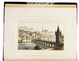
London, (back of title-page: printed by A. Straham), 1818. 4to. With 15 hand-coloured aquatints on 11 plates by I. Clark after drawings by author. 19th-century half morocco (Root bookbinders, London), richly gold-tooled spine. XIII, 295 pp. Full description
€ 1,950
Order Inquire Terms of sale

From India to Egypt, with 19 hand-coloured plates and 2 maps

NOÉ, Louis Pantaléon Jude Amédée, Comte de. Mémoires relatifs a l'expédition Anglaise partie du Bengale en 1800 pour aller combattre en Égypte l'armée d'orient.
Paris, Imprimerie Royale (back of half-title: [Auguste] Nepveu), 1826. 8vo. With 2 folding lithographed maps, partly coloured by hand, and 19 hand-coloured lithographed plates. Contemporary red half morocco, gold-tooled spine, marbled sides. [3], [1 blank], III, [1 bank], 288 pp. Full description
€ 1,750
Order Inquire Terms of sale

British India's foreign trade during the years 1874-1884

O'CONOR, James Edward. Review of the accounts of the trade and navigation of India for 1874-75, as compared with previous years.
Calcutta, Office of the superintendent of government printing, 1876.
With:
(2) Memorandum reviewing the accounts of the trade and navigation of British India for 1875-76. Dated the 24th February 1877.
[Calcutta?], Government central press, 1877.
(3) Review of the trade of British India for the official year 1876-77.Calcutta, 25 October1877.
(4) Review of the trade of British India with other countries, for the official year 1878-1879.
[Calcutta?], Government central press, 1879.
(5) Review of the maritime trade of British India with other countries for the official year 1879-80.Calcutta, office of the superintendent of government printing, 1880.
(6) Review of the maritime trade of British India with other countries for the official year 1880-81.Calcutta, office of the superintendent of government printing, 1881.
(7) Review of the maritime trade of British India with other countries for the official year 1881-82.Calcutta, office of the superintendent of government printing, 1882.
(8) Review of the accounts of the sea-borne foreign trade of British India for the official year ending 31st March 1883.Simla, Government central branch press, 1883.
(9) Review of the accounts of the sea-borne foreign trade of British India for the official year ending 31st March 1884.Simla, Government central branch press, 1884.
9 parts in 1 volume. Folio. Near contemporary red cloth. Full description
€ 6,500
Order Inquire Terms of sale

The history of the Austro-Hungarian region from 1395-1612

OERTEL (ORTELIUS), Hieronymus. Chronologia oder historische Beschreibung aller Kriegsempörungen unnd Belägerungen der Stätt und Vestungen auch Scharmützeln und Schlachten so in Ober und Unter Ungern auch Siebenbürgen mit dem Turcken von Ao. 1395 biss auff gegenwertige Zeit denckhwürtig geschehen.
Nuremberg, Christoff Lochner for Johann Sibmacher, 1604.
With:
(2) OERTEL, Hieronymus. Continuatio des Hungerischen und Sibenbürgischen Kriegwesens vom 1. Januari anno 1603 bis auf jetziges 1604.
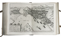
Nuremberg, Christoff Lochner for Johann Sibmacher, 1604. With engraved title in elaborately decorated border with cavalry, arms and armour, large engraved folding map (28×51 cm), 30 double-page engraved views, 26 full-page engraved portraits, woodcut initials and head- and tailpieces.
(3) OERTEL, Hieronymus. Viertter Thail des Hungerischen und Sibenbürgischen Kriegswesens, was sich seithero Anno 1604 bis auf Ao. 1607 inn der ausgestandnen Rebellion mit dem Türcken, Rebellen und ihrem Anhang . . . zugetragen . . .
[Nuremberg, ca. 1613]. With engraved title-page, and engraved portrait of the author signed "H.V."
(4) OERTEL, Hieronymus. Appendix partis quartae Chronologiae Ungaricae, das ist; warhafftige ausführliche historische Beschreibung: was gestallt der aller durchleuchtigist Fürst und Herr herr Matthias Ertz Herzog zu Oesterreich, etc. Montags den 19 Novembris anno 1608 . . . und zum Römischen Kayser erkäret worden (ist; 1612) . . .
Nuremberg, Wolffgang Endter for the heirs of the author, 1622. With engraved portrait of author on the back of the title-page, and a folding engraved plate showing cavalry. 4 volumes bound as 1. 4to. Contemporary vellum. [6], 581, [34], [10]; [2], 35, [1]; [12], 195, [12]; [2], 302, [7] pp. Full description
€ 17,500
Order Inquire Terms of sale

Ottoman manuscript atlas of the western (mostly European) parts of the Ottoman Empire, with 10 maps

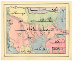
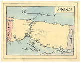
[OTTOMAN ATLAS - MANUSCRIPT]. [Atlas of the western Ottoman Empire].
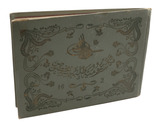
Ottoman Empire, ca. 1910. Oblong 4to (26.5 x 19.5 cm). 14 leaves with 10 pen-and-ink maps, hand coloured with watercolours. Tissue guards. Gold-stamped cloth with the tughra of Mehmed V (ruled 1908-18) on the front board (when reading right to left) and "Album" on the back board (the front when reading left to right), with an inscription below the tughra and the European numerals "16" and "2" flanking an ornament below the inscription, the whole framed by 4 large floral cornerpieces. Full description
€ 8,500
Order Inquire Terms of sale

Very rare (first?) edition of an Ottoman-French treaty that solidified French influence in the Ottoman Empire during the 18th century

[OTTOMAN CAPITULATIONS OF 1740]. [Kitabi-i ahdname-i hümayun-u saadet-makrun].
[Paris or Istanbul?], [1816 or 1835?]. Large 4to (31.5 x 24 cm). The text of an Ottoman-French treaty, set in the Ottoman Turkish alphabet, a version of the Arabic script. Half calf, marbled paper sides, gold-tooled spine. 45, [1 blank] pp. Full description
€ 15,000
Order Inquire Terms of sale
101 books found / Show all