Categories
Shopping cart (0 items € 0)
Advanced search

Middle East & Islamic World / Central & West Asia

Adventurous travels in the East
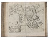
MANDELSLO, Johann Albrecht von. Morgenländische Reyse-Beschreibung.
Hamburg, Christian Guth, printed by Johan Holwein, Schleswig, 1658. Folio. With engraved frontispiece by Christian Rothgiesser, engraved author's portrait, double-page engraved map, and 21 large engravings in text, mostly signed by Rothgiesser. Contemporary pigskin, with boards blind-tooled in a panel design. [32], 248, [36] pp. Full description
€ 11,000
Order Inquire Terms of sale

14th-century tales of travels in Turkey, the Middle East, Near East, India and the East Indies,
illustrated with about 60 woodblocks

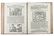
MANDEVILLE, John [= Jehan d'OUTREMEUSE]. The voyages & travels of Sir John Mandevile, Knight, ... to the Holy Land, and to Hierusalem: as also to the lands of the Great Caan, and of Prestor John: to Inde, and divers other countries: ...
London, Richard Chiswell, Benjamin Walford, Matthew Wotton, George Conyers, 1696. 4to. With a woodcut ship on the title-page and about 60 woodcut illustrations in the text (mostly about 5.5 x 8 cm) plus about 10 repeats. Gold-tooled, red goatskin morocco by Robert Riviere in London (ca. 1875/80), one of England's best binders. [4], “139” [= 135], [5] pp. Full description
€ 22,500
Order Inquire Terms of sale

An Arabist advocating archaeological research of the Near East

MANGER, Samuel Hendrik. Oratio inauguralis, de incremento philologiae sacrae ab idonea Arabiae atque Palaestinae exploratione sperando.
Franeker, Willem Coulon, 1762. Folio. With the woodcut coat of arms of Friesland on the title-page. Mid-19th-century marbled wrappers. [4], 67, [1 blank] pp. Full description
€ 1,250
Order Inquire Terms of sale

A collection of Venetian voyages to the Near and Middle East, printed at the Aldine press

[MANUZIO, Antonio (ed.)]. Viaggi fatti da Vinetia, alla Tana, in Persia, in India, et in Costantinopoli: con la descrittione particolare di città, luoghi, siti, costumi, & della porta del Gran Turco: & di tutte le intrate, spese, & modo di governo suo, & della ultima impresa contra Portoghesi.
Venice, sons of Aldus Manutius, 1545. 8vo. With Alduss woodcut anchor device on the title-page. 18th-century English polished calf. 163 ll. Full description
€ 7,500
Order Inquire Terms of sale

Cross-cultural mapping of the Red Sea: Bruce's chart in an early Egyptian manuscript copy

[MAP - ARABIAN PENINSULA]. BRUCE, James. Carte de la mer Rouge, relevée sur celle de James Bruce.
[Egypt, probably Cairo], 1827. Folio leaf (46 x 31.5 cm). Manuscript map in pen and ink with watercolour, with a French text on Middle Eastern hand-made paper. Full description
€ 15,000
Order Inquire Terms of sale

Ottoman map of Iraq, Kuwait and southwestern Iran, used by its army in World War I

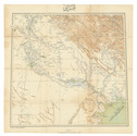
[MAP - OTTOMAN ARMY]. [Iraq, Kuwait and Iran].
Istanbul, [Erkan-i Harbiye-i Umumiye], 1331 Rumi [= 1915 CE]. Colour-lithographed map of Iraq, Kuwait and southwestern Iran (65.5 x 66 cm) in black, brown, blue and green at a scale of 1:1,000,000, dissected into 12 sections and mounted on contemporary cloth. Full description
€ 3,500
Order Inquire Terms of sale

Field guide for officers during the Mesopotamian campaign (1914-1918), with a folding map

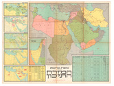
[MESOPOTAMIA]. [Indian Army General Staff]. For official use only. Field notes. Mesopotamia. General staff, India. February 1917.Including: Index to field notes, Mesopotamia, 1917.
Calcutta, Superintended government printing, 1917. Small 8vo. With 1 folding heliozincographed map of "Lower Mesopotamia", with some routes in red, and three folding letterpress tables. Original green cloth. [3], [1], 326(=325), [1]; [1], [1 blank], XX pp. Full description
€ 6,500
Order Inquire Terms of sale

"For offical use only": mapping the Mesopotamian battlefields of WWI

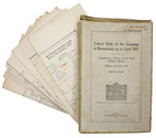
[MESOPOTAMIAN CAMPAIGN]. Critical study of the campaign in Mesopotamia up to April 1917. Part II - Maps.
Calcutta, Government of India Press, 1925. 25 (of 26) folding maps, sketches etc., as always lacking the "Explanation of the Method of giving Map Co-ordinates adopted in Chapters XIII and XX". Original tan cloth map-case with original printed label to cover. 25 (of 26) folding ll. Full description
€ 3,500
Order Inquire Terms of sale
127 books found / Show all