Categories
Shopping cart (0 items € 0)
Advanced search

Middle East & Islamic World / Cartography & Exploration

Rare handbooks of the British naval intelligence division on Arabia, Palestine, and Syria

NAVAL INTELLIGENCE DIVISION. Syria. April 1943.
With:
(2) IDEM. Palestine and Transjordan. December 1943.
(3) IDEM. Western Arabia and the Red Sea. June 1943.
Stationery Office, University Press Oxford, 1943-1946.
3 volumes. Many plates, tables and photographs. Each volume including separate fold-out maps, one in colour. Contemporary green cloth with the title in gold on the front boards and the spines. [2], XVI, 485, [1]; [2], XV, [1], 621, [1]; [2], XIX, [1], 659, [1] pp. Full description
€ 1,750
Order Inquire Terms of sale

Manuscript log of a voyage from Suez through the Red and Arabian Seas to Bombay, Karachi and Colombo, with 8 excellent nautical charts and 5 beautiful sketches, including one of the city of Muscat

[OMAN NAVIGATION LOGBOOK]. MCKINNELL, Thomas, assistant master. Log of the proceedings. HMS "Cyclops". W. J. S. Pullen Esq. Captain. Commencing Monday 7th February 1859, ending Wednesday 22nd of May, 1861. Kept by Thos. McKinnell, Mast. Asst.
HMS Cyclops: Oman, Khuriya Muriya Islands, Yemen, Egypt, Red Sea, Arabian Sea, Pakistan, Sri Lanka and other places, 1857-1861. Folio (20 x 31.5 cm). Over 360 pp. of manuscript entries, written with brown ink in a legible hand on watermarked laid paper with a blue cast. With 8 pen and ink nautical charts and 5 sketches of coastal sites, including the city of Muscat (8 on the logbook pages and 5 on separate thick album leaves). Contemporary brown cloth over boards, rebacked in period-style black calf with the spine lettered in gold: "Log H.M.S. Cyclops". [ca. 360], [32 blank] pp. Full description
€ 45,000
Order Inquire Terms of sale

Ottoman manuscript atlas of the western (mostly European) parts of the Ottoman Empire, with 10 maps

[OTTOMAN ATLAS - MANUSCRIPT]. [Atlas of the western Ottoman Empire].
Ottoman Empire, ca. 1910. Oblong 4to (26.5 x 19.5 cm). 14 leaves with 10 pen-and-ink maps, hand coloured with watercolours. Tissue guards. Gold-stamped cloth with the tughra of Mehmed V (ruled 1908-18) on the front board (when reading right to left) and "Album" on the back board (the front when reading left to right), with an inscription below the tughra and the European numerals "16" and "2" flanking an ornament below the inscription, the whole framed by 4 large floral cornerpieces. Full description
€ 8,500
Order Inquire Terms of sale

Probably the first manual for the use of chronometers at sea

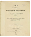
OWEN, William Fitzwilliam (ed.) & Richard OWEN. 
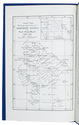
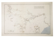
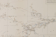
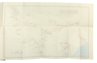
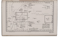
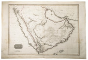
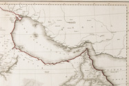
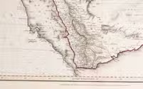
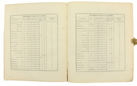
Tables of latitudes, and longitudes by chronometer, of places in the Atlantic and Indian Oceans; principally of the west and east coast of Africa, the coasts of Arabia, Madagascar. &c. resulting from the observations of H.M.S. Leven and Barracouta, in the years 1820 to 1826 inclusive, ... To which is prefixed an essay on the management and use of chronometers ...
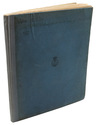
London, George Duckworth and William Ireland, 1827. 4to. Contemporary blue boards for the Danish Navy Library, later backed with cloth. [2], 33, [3], 16, [36], 8 pp Full description
€ 2,500
Order Inquire Terms of sale

Warmly inscribed by the author

PALGRAVE, William Gifford. Personal narrative of a year's journey through Central and Eastern Arabia (1862-63).
London and New York, Macmillan and Co., 1871. 8vo (ca. 13 x 19 cm). With a linen-backed folding map and 3 extending plans. Contemporary half morocco with maroon cloth over boards, gilt, front board stamped with the owner's initials "G.W.T.", marbled endpapers. [2], VI, [4], 421, [1] pp. Full description
€ 2,500
Order Inquire Terms of sale

Traversing Qajar Persia with a manuscript guide

[PERSIA - TRAVEL GUIDE]. [Manuscript travel guide].
[Qajar Iran, ca. 1850s]. 8vo (12.5 x 22 cm). Persian manuscript on polished paper. Black nasta'liq script in 15 lines per page, ruled in green and blue, with rubricated chapter headings and marginal medallions. Contemporary limp leather and woven floral-patterned cloth. 26 ll. Full description
€ 8,500
Order Inquire Terms of sale

The first European crossing the Rub' al-Khali (Empty Quarter) of Arabia from east to the west

PHILBY, Harry St. John Bridger and Alfred Felix Landon BEESTON. Sheba's daughters beign a record of travel in southern Arabia. With an appendix on the rock inscriptions by A.F.L. Beeston.
London, Methuen & Co., [1939]. 4to. With photographic frontispiece, 46 photographic plates (1 of which double-page), 1 folding map of southern Arabia, and several photographic illustrations in the text. Contemporary light yellow cloth with giltstamped title and ornament to the spine. XIX, [1 blank], 485, [1] pp. Full description
€ 350
Order Inquire Terms of sale

Travelling in the Hadramaut: the longest journey of Philby through southern Arabia

PHILBY, Harry St John Bridger. The land of Sheba (The Geographical Journal Vol. 92, no. 1).
[United Kingdom, The Royal Geographical Society], July 1938. 8vo. With 1 large folding coloured map, 1 smaller uncoloured folding map, and numerous photographs on 7 plates. Later half black cloth. 21, 107-132 pp. Full description
€ 300
Order Inquire Terms of sale
123 books found / Show all