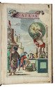
Cross-cultural navigation: Turkish-inscribed maritime pilot
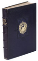
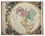
COLOM, Jacob Aertsz.
[Description de la mer méditerranée].
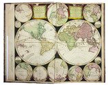
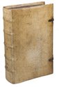
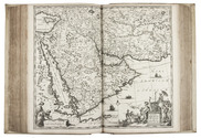
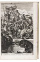
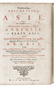
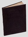
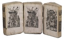
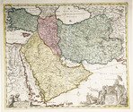
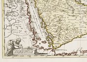
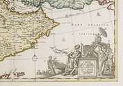
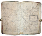
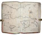
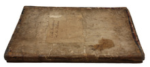
[Amsterdam, ca. 1670]. Folio (29 x 45 cm). With 9 double-page engraved charts only, each sheet ca. 44 × 55 cm, each mounted on stiff paper with maps back-to-back, with thick red and black ink borderlines. 8 of 9 maps are by Colom, numbered 2-9 in the plates from; plate 1 has been replaced with Johannes de Rams map of the Mediterranean: "Paskaart vande Middelandsche Zee In twee deelen vertoont". Contemporary stiff paper wrappers, with a manuscript label pasted upside down on the back wrapper, reading: "Carta Marinaresca del Mar Mediterraneo". Full description
€ 25,000
[Amsterdam, ca. 1670]. Folio (29 x 45 cm). With 9 double-page engraved charts only, each sheet ca. 44 × 55 cm, each mounted on stiff paper with maps back-to-back, with thick red and black ink borderlines. 8 of 9 maps are by Colom, numbered 2-9 in the plates from; plate 1 has been replaced with Johannes de Rams map of the Mediterranean: "Paskaart vande Middelandsche Zee In twee deelen vertoont". Contemporary stiff paper wrappers, with a manuscript label pasted upside down on the back wrapper, reading: "Carta Marinaresca del Mar Mediterraneo". Full description