Categories
Shopping cart (0 items € 0)
Advanced search

Low Countries / Cartography & Topography

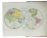
Historical map of the Netherlands, printed on silk, together with the separately published manual, with a hand-coloured world map
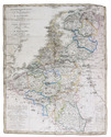
MAASKAMP, Evert. Geschiedkundige kaart der Nederlanden. | Carte historique des Pays-Bas.
Amsterdam, Evert Maaskamp, 1830. Map (plate size 48 x 38 cm) engraved by "Giersbergen et fils", printed on silk and hand-coloured in outline, with the title at upper left, a dedication at lower left, and a key and scale (ca. 1:1,000,000) at lower right.
With: (2) MAASKAMP, Evert. Handboek, ter verklaring der geschiedkundige kaart van het Koningrijk der Nederlanden, en der wereldkaart; behelzende eene opgave van de roemrijkste en lofwaardste daden der Nederlanders, derzelver krijgsbedrijven te land en ter zee, scheepstochten, ontdekkingen, uitvindingen enz.; als mede van zoodanige voorname personen, die in wetenschap, kunst of heldenmoed, hebben uitgeblonken.
Amsterdam, Evert Maaskamp, 1830. 8vo. With a folding engraved map of the world, with the continents hand-coloured. Contemporary red boards, boards gold-tooled along the extremities. VIII, 8, 1-38, 37-77, [1 blank], [1], [1 blank]. Full description
€ 1,500
Order Inquire Terms of sale

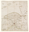
Very detailed manuscript map of the Duchy of Guelders and surroundings (ca. 1580/1600) with 7 provincial coats of arms, the whole in coloured inks and gold on parchment

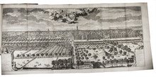
[MAP - GELDERLAND - MANUSCRIPT]. [SGROOTEN, Christiaan]. Gelderlant.
[Gelderland?], [ca. 1580/1600]. (36 x 37.5 cm; map image 35.5 x 36.5 cm). Manuscript map in coloured inks (and gold) on parchment (at a scale of about 1:315,000, with north to the left, covering about 51.4-52.8° N latitude and 4.9-6.8° E longitude), with 7 provincial coats of arms (rendered in colour and gold), three different variable scales (presumably intended as miles) in the lower right corner (2 units ranging from 30 to 45 mm) and a 6 cm square-rigged, two-masted ship in the Zuyder Zee. It shows rivers in dark blue, lakes and seas in light blue, hills in brown and trees in green, both highlighted with gold, and political regions both shaded and outlined in various colours. Cities and hundreds of towns and villages appear in red, the cities shown in profile with a gold dot, the others indicated by red dots, and all their names (and the names of regions) written quite clearly in brown ink. The whole map has a border in red ink on all four sides, with "Noordt" (North) lettered in gold capitals and small capitals in the right border. Full description
€ 32,500
Order Inquire Terms of sale

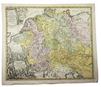
Hand-coloured engraved map showing the rivers of Germany and the Low Countries

[MAP - GERMANY - LOW COUNTRIES]. HOMANN, Johann Baptist. Hydrographia Germaniae qua geographiae naturalis ea pars quae de aquis celebrioribus praesertim vero de fluminibus Germaniae agit...
Nuremberg, Johann Baptist Homann, [ca. 1710?]. Engraved map (48.5 x 58 cm) on a whole sheet of paper (53 x 63.5 cm), coloured in an early hand, with the title in an illustrated cartouche with Neptune and other mythological figures at lower left, an illustrated cartouche at upper left with a coat of arms, and a scale (ca. 1:2,400,000) in the margins. Full description
€ 200
Order Inquire Terms of sale

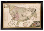
Rare wall map of the Gooi, coloured by a contemporary hand

[MAP - HET GOOI]. POST, Hendrik. Nieuwe kaart van Gooilandt word met schuldige eerbiedigheidt aan den wel. ed. gestr. Heere en Mr. Henrick Bicker schepen der stadt Amsterdam, raadt en advt. fiscaal ter Admiraliteit aldaar meestersknaap van Gooilandt, enz, enz. opgedragen door Reinier & Josua Ottens.
Amsterdam, Reinier & Josua Ottens. [ca. 1737]. 52.5 x 82 cm. Framed. Full description
€ 28,000
Order Inquire Terms of sale

Fine wall map coloured by a contemporary hand

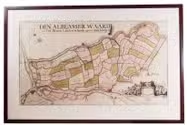
[MAP - NETHERLANDS - ALBLASSERWAARD]. ]. Den Alblasserwaard en Vyf Heeren Landen, te samen groot 33110. mergen. Nieuwe caerte vertoonende den geheelen Alblasserwaert. Nieuwlycx uytgegeven door Abel de Vries landmeter tot Dordrecht 1716. Met een nette aanwijzing der dijkbreuken en hulpgaten van 't jaar 1740 en 1741. uytgegeeven door Matth. de Vries.
[Dordrecht], Matthias de Vries, [ca. 1741]. 66 x 117 cm. Wall-map on 4 sheets, originally engraved by Bastiaan Stopendaal (1637-1693), in contemporary hand colouring. Framed (93 x 143 cm). Full description
€ 9,500
Order Inquire Terms of sale

Collection of 6 maps of the Beemster polder 1644-1979

[MAP - NETHERLANDS - BEEMSTER]. FLORISZ. VAN BERCKENRODE, Balthasar and Daniel van BREEN. Beemsterlants caerte... [with a second title at the head:] Ware afbeeldinge vande bedyckte Beemster-landen... M.DC.XLIIII.
Amsterdam, 1644 [reprinted ca. 1769?].
And:
(2) [FLORISZ. VAN BERCKENRODE, Balthasar] and Daniel van BREEN. Beemsterlants caerte...
Amsterdam, 1658. Engraved map (43.5 x 58 cm).
(3) [MAP - NETHERLANDS - BEEMSTER]. Beemster landts kaarte, aenwijsende de hoogte vande ringhdyck. Als mede de diepte vande tocht & wech slooten.
[Amsterdam(?), ca. 1696].
(4-5) DORLAND, C. [2 maps of the Beemster].
Amsterdam, Tresling & Co., March 1908.
(6) [MAP - NETHERLANDS - BEEMSTER]. Waterschap de Beemster.
February 1970, updated to 1979. Large map (64 x 50 cm).
Collection of 6 maps (the first in 6 sheets). Engraved map in 6 sheets (each 56 x 44 cm). With the main title in a large cartouche at right, the statement about its production and a scale of Rijnland rods in a pedestal at the foot, a Latin verse in praise of the Beemster polder by Caspar van Baerle at lower right, a compass rose at upper right, and the arms of Beemster at the head. Bound in modern cloth (57.5 x 47 cm). Full description
€ 3,750
Order Inquire Terms of sale

Rare 18th-century wall map of the Netherlands

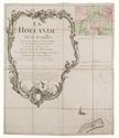
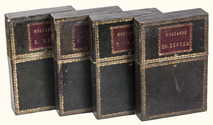
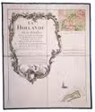
[MAP - NETHERLANDS]. [LE ROUGE, George-Louis]. La Hollande en 12 feuilles.
Paris, Jean Dezauche, 1790. Published on 12 sheets, numbered as 48 quarter-sheets. An engraved wall map of the Netherlands (excluding Zeeland), with the main title in a large cartouche at upper left, the Latin title at upper right. Many cities and coastlines, and a few other features, highlighted in colour. Cut, mounted on cloth and folded, in 4 contemporary gold-tooled green morocco boxes. Full description
€ 8,500
Order Inquire Terms of sale

Two large wall maps of the Dutch provinces, from the library of Marco-Antonio III (1730-1800), Prince Borghese

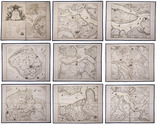
[MAPS - NETHERLANDS]. [LE ROUGE, George-Louis]. La Hollande en 12 feuilles dont les six premieres contiennent la Hollande ...
Paris, Jean A. Dezauche, successor of Delisle & Buache, 1790. Together ca. 230 x 155 cm. Engraved map, hand-coloured in outline. Printed on 12 sheets, each divided into 4 segments, numbered 1-48. The 12 sheets are mounted on contemporary linen and folded, the edges reinforced with blue ribbon.
With: (2) LE ROUGE, George Louis. Topographie de la Zelande en 9 feuilles traduitte de l'Hollandois. [Second title:] Partie orientale de la Flandre Hollandoise, ...
Paris, Jean A. Dezauche, 1790. Large engraved wall map, hand-coloured in outline, printed on 9 numbered sheets, each divided into 4 segments, numbered 1-36 (each sheet 48 x 56.5 cm); the 36 segments are mounted on contemporary linen, the edges reinforced with blue ribbon. Each map in contemporary box. Full description
€ 8,950
Order Inquire Terms of sale

Topographical wall map of the Dutch (polder) district Vijfheerenlanden,
including the very rare engraved borders with coats of arms

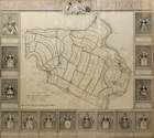
OTTENS, Reinier and Josua OTTENS. Nieuwe kaart van de Vyf Heeren landen gelegen tusschen den Dief en Zouwen dyk.
Amsterdam, Reinier and Josua Ottens, 1741. Engraved map on 4 sheets (85 x 98 cm as assembled), with an engraved title ("Kaart van de Vyf Heerenlanden") with the coat of arms of the water district at the head, and surrounded by 14 engraved coats of arms at the left, right and foot (measuring 122 x 134 cm in total). The map with the title and publisher at the foot left, together with a scale (ca. 1:19,000) and the name of the engraver at the right (Jan van Jagen). Framed. Full description
€ 6,500
Order Inquire Terms of sale

Extremely rare bound copy of a mid-19th-century panorama cityscape of the Dutch city of Rotterdam

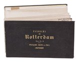
[PANORAMA - ROTTERDAM]. Johan Conrad GREIVE jr. (illustrator). Panorama de Rotterdam.
Amsterdam, [printed by R. de Vries for] François Buffa & Sons, [1861]. Oblong (14.5 x 25 cm). The panorama is made up of 6 numbered views, which were originally published on three loose leaves of 2 views per leaf. The viewer looks northward from the river Meuse over the city from the old "sailor's house" (zeemanshuis) in the west along the Willemskade and the Haringvliet to the train station and large warehouse (rijks entrepot) in the east. Original brown blind-stamped wave-grained cloth. 6 numbered views folded making 12 pages. Full description
€ 4,950
Order Inquire Terms of sale
56 books found / Show all