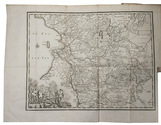
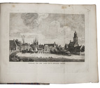
Beautiful wall map of Rijnland
DOU, Jan Jansz. (Johannes Dou I), Steven van BROECKHUYSEN and Melchior BOLSTRA.
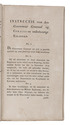
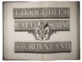
'T Hooge Heemraedschap van Rhynland.
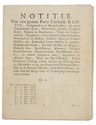
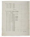
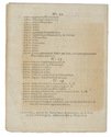
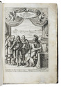
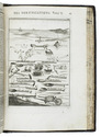
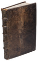
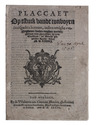
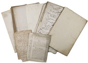
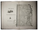
[Amsterdam], Isaak Tirion, 1746. Atlas folio (58.5 x 37.5 cm). With 15 double-page engraved plates (plate size mostly ca. 44.5 x 55 cm and ca. 41.5 x 55 cm), including 13 maps (that of the Haarlemmermeer with plate size 55 x 63 cm), an illustration of existing and projected sluices for drainage of the polder and another illustration with title, both after drawings by Melchior Bolstra. All plates mounted on stubs so that they open flat. Half calf. Full description
€ 5,000
[Amsterdam], Isaak Tirion, 1746. Atlas folio (58.5 x 37.5 cm). With 15 double-page engraved plates (plate size mostly ca. 44.5 x 55 cm and ca. 41.5 x 55 cm), including 13 maps (that of the Haarlemmermeer with plate size 55 x 63 cm), an illustration of existing and projected sluices for drainage of the polder and another illustration with title, both after drawings by Melchior Bolstra. All plates mounted on stubs so that they open flat. Half calf. Full description