Categories
Shopping cart (0 items € 0)
Advanced search

Cartography & Exploration / Geography, Topography & Views

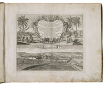
12 engraved views and costumes from North Holland

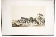
GREEVEN, Hendrik. Tableaux des costumes, moeurs, coutumes et vues, de la Nord-Hollande, de Zaandam, Broek, Alkmaar, Assendelft et de l'Île de Marken.
Amsterdam, Evert Maaskamp, [ca. 1826]. Oblong 4to (22.5 x 29 cm). With an engraved map of North Holland by C.H. Koning on title-page and 11 engraved plates, mostly engraved by Willem van Senus after Hendrik Greeven, all protected by tissue guards. Contemporary boards; preserved in a modern cloth clamshell box. [2] ll. + 10 plates. Full description
€ 1,750
Order Inquire Terms of sale

First edition of Guicciardini's celebrated 16th-century description of the Low Countries
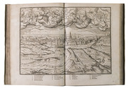
GUICCIARDINI, Ludovico. Descrittione ... di tutti i Paesi Bassi, altrimenti detti Germania Inferiore.
Antwerp, Willem Silvius, 1567. Folio. With the title, the large coat of arms of Philip II, and his portrait set within a woodcut architectural frame with allegorical figures on separate pages, 5 double-page woodcut maps (including 1 folding), 4 double-page woodcut views of cities, 6 double-page woodcut plans of cities, and 2 double-page illustrations of buildings (1 woodcut, 1 engraved). Further with 15 woodcut divisional title-pages for the illustrations and descriptions of the regions and cities set within a woodcut ornamental frame and numerous woodcut decorated initials (at least 4 series) Later overlapping vellum, sewn on 3 parchment tapes laced through the joints. [3], [1 blank], [16], "296"[= 339], [1 blank], [19], [1 blank] pp. Full description
€ 7,500
Order Inquire Terms of sale

Exceptionally rare first edition of an unrivalled plate collection containing plans of antique cities

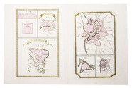
[HASE, Johann Matthias]. Plans des villes que passent pour les plus grandes de l'antiquité, et de nos jours ...
Nuremberg, Homann heirs, 1745. Folio. With 15 hand coloured, numbered, engraved plates. Modern folder, marbled paper over boards. Each leaf (ca. 56 x 66 cm) is separately mounted in a passe-partout (ca. 60 x 78 cm). [8] ll. Full description
€ 2,500
Order Inquire Terms of sale

Charming lithographed topographic and architectural views of northern France

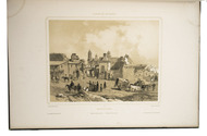
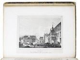
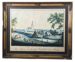
HÉDOUIN, Pierre. Souvenirs historiques et pittoresques du nord de la France, ou Collection des plus belles vues et des plus beaux monumens, de cette partie de la France.
Paris, Dondey-Dupré, père et fils, 1830. Super Royal 4to (34.5 x 27 cm). With a letterpress half-title, title-page, 4-page letterpress introductory letter from Hédouin (dated 14 August) and 25 somewhat irregularly numbered, finely lithographed plates (mostly in landscape orientation with image size ca. 14.5 x 20 cm but the largest in portrait orientation 23.5 x 18 cm), printed on thin so-called "China" paper and mounted on blank leaves, each with a view of a site in northern France, by Pierre Langlumé after various artists, each followed by a letterpress account of the site. Modern half calf over contemporary boards with shell on shell marbled sides. [56] pp. Full description
€ 1,950
Order Inquire Terms of sale

Fine work illustrating the cities, ports, and factories of the Dutch East India Company in Asia and Africa

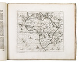
HEYDT, Johann Wolffgang. Allerneuester Geographisch und Topographischer Schau-Platz, von Africa und Ost-Indien.
Nuremberg, C. Tetschner, 1744. Oblong folio (31 x 36.5 cm). With 115 numbered engraved maps and plates, an engraved frontispiece, and an engraved title-page. Contemporary vellum, with the author and title lettered in gold on the spine, red edges. [24], 345, [4] pp. Full description
€ 17,500
Order Inquire Terms of sale

Dutch translation of the first schoolbook for geography to be used in Europe

HUBNER, Johann. Kort begrijp der oude en nieuwe geographije; zijnde eene beknopte onderwijzinge der land en kaartkennis; verhandeld in een beschrijvinge der geheele vlakte des aardboodems ... Met een korte schets, tot kennisse der globe. Deze twede druk, merkelijk verholpen; met ... aanwijzing der beste landkaarten ...
Amsterdam, Nicolaas ten Hoorn, 1711. 8vo. With Ten Hoorns woodcut device on the title-page (incorporating a NTH cypher monogram, woodcut initials and tailpieces. Contemporary vellum. [52], 766, [56] pp. Full description
€ 1,950
Order Inquire Terms of sale

A Dutch commander's Japanese diary with a large lithographed map

HUYSSEN VAN KATTENDYKE, Willem Johan Cornelis. Uittreksel uit het dagboek van W.J.C. Ridder Huyssen van Kattendyke, Kapitein-Luit. ter zee, gedurende zijn verblijf in Japan in 1857, 1858 en 1859.
The Hague, W.P. van Stockum (printed by Giunta d'Albani), 1860. 8vo. With large folding lithographed map (67 x 54.5 cm) depicting the west coast of Japan and Kiusiu, by E. Spanier after H.O. Wichers. Contemporary gold-tooled red sheepskin (morocco), gilt edges, silk-watered endpapers. [2 blank], [10], 236 pp. Full description
€ 4,000
Order Inquire Terms of sale

Over 200 scientific articles on Western & Central Asia and India, bound in 107 volumes

[JOURNALS – WESTERN AND CENTRAL ASIA; INDIA], Olaf CAROE, Aurel STEIN, Richard TEMPLE, Francis YOUNGHUSBAND et al. [Large collection of journal articles about the scientific exploration of Western and Central Asia and India].Including:
- Journal of the Royal Asiatic Society.
- Geographical Journal.
- Journal of the Asiatic Society of Bengal.
- Journal of the Royal Central Asian Society.
- Journal of the Royal Geographical Society.
- Transactions of the Bombay Geographical Society.
- National Geographic.
Various places, a.o. London and Calcutta, various publishers, 1837-1981. 107 volumes, many containing multiple articles. 8vo. Some illustrated with plates and maps. Half calf with marbled sides and gilt lettering on spine or cloth with marbled sides and label on spine. Full description
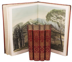
€ 35,000
Order Inquire Terms of sale
88 books found / Show all