In search of a northeast passage
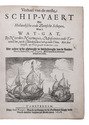
VEER, Gerrit de.
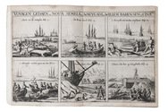
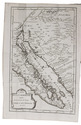
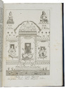
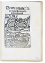
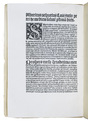
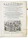
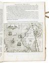
Tre navigationi fatte dagli Olandesi, e Zelandesi al settentrione nella Norvegia, Moscovia, e Tartaria verso il Catai, e regno de' Sini, doue scopersero il Mare di Veygatz, la Nuova Zembla.
Venice, Giovanni Battista Ciotti, 1599. 4to. With an engraved plate on title-page, full-page engraving of a compass and 31 half-page engraved maps and plates in text. Later vellum. [4] 79 ll. Full description
€ 8,500
Venice, Giovanni Battista Ciotti, 1599. 4to. With an engraved plate on title-page, full-page engraving of a compass and 31 half-page engraved maps and plates in text. Later vellum. [4] 79 ll. Full description