Categories
Shopping cart (0 items € 0)
Advanced search

Cartography & Exploration

Catalogue of the famous Portland Museum, with many objects collected during Cook's Pacific voyages,
with manuscript prices and purchasers
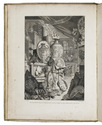
[PORTLAND MUSEUM]. [LIGHTFOOT, John]. A catalogue of the Portland Museum lately the property of the Duchess Dowager of Portland, deceased: which will be sold by auction ...
With: (2) A catalogue of a very valuable collection of cameos, intaglios, and precious stones, and other curiosities; being part of a late much celebrated cabinet, many out of the Arundel collection; which will be sold by auction ...
[London, Skinner and Co., 1786]. 2 works in 1 volume. 4to. With full-page engraved frontispiece showing the interior of the Portland Museum with numerous objects from its collection. Contemporary gold-tooled vellum. VIII, "194" [= 192]; 6 pp. Full description
€ 18,500
Order Inquire Terms of sale

The first English voyage to Hawaii after Captain James Cook's

PORTLOCK, Nathaniel. Reis naar de noord-west kust van Amerika. Gedaan in de jaren 1785, 1786, 1787 en 1788.
Amsterdam, Matthijs Schalekamp, 1795. 4to. With folding engraved map (34.5 x 46 cm) showing the routes of the ships King George and Queen Charlotte, 1 plate with engraved music and 8 folding engraved plates (last plate partly hand-coloured). Modern red half leather. XII, [4], 265, [1] pp. Full description
€ 2,750
Order Inquire Terms of sale

8 complete print series with text, forming the collected architectural work of Pieter Post

POST, Pieter. Les ouvrages d'architecture.
Leiden, Pieter van der Aa, 1715. 8 parts in 1 volume. Royal folio (46 x 29.5 cm). With an engraved general title-page with a rectangular frame and a cartouche with Athena, architecture books and buildings, letterpress general title-page in red and black with engraved vignette (Athena with a view of Leiden, drawn by J. Goeree), 8 letterpress part-titles, 3 engraved part-titles, engraved dedication, a folding engraved portrait of Prince Johan Maurits after Govert Flinck by C. van Dalen (filling a whole Imperial sheet: plate size 60.5 x 46 cm!), and 8 series of 6, 12, 8, 5, 11, 7, 4 and 23 mostly double-page and some larger folding etched and engraved numbered plates after designs by Pieter Post, showing architectural plans, elevations, sections, etc. In total about 80 copperplates. Mottled calf (ca. 1750). [8], 6; 8; 10; 8; 12; 5, [1 blank]; 6; [2], 8 pp. plus plates. Full description
€ 12,500
Order Inquire Terms of sale

Authoritative but fictional travel account, including adventures at the young colony of Georgia

[PRÉVOST D'EXILES, Antoine François]. Voyages du Capitaine Robert Lade en differentes parties de l'Afrique, de l'Asie et de l'Amerique: contenant l'histoire de la fortune, & les observations sur les colonies & le commerce des Espagnols, des Anglois, des Hollandois, &c. Ouvrage traduit de l'Anglois.
Paris, Claude Simon for François Didot, 1744. 2 volumes. 12mo. With two folding engraved maps by F. Desbruslins after Jacques-Nicolas Bellin, showing the American Atlantic coast and the route of the journey. Contemporary mottled calf, richly gold-tooled spine. [1], [1 blank], XVI, 370; [1], [1 blank], 400 pp. Full description
€ 1,800
Order Inquire Terms of sale

Voyage to the Cape, India and Java

PRIOR, James. Beschrijving eener reis naar de Indiesche zee met het fregat de Nisus en naar de Kaap De Goede Hoop, de eilanden Bourbon, Mauritius en andere; naar Madras, de eilanden Java, Sint Paul en Amsterdam gedurende de jaren 1810 en 1811.
Amsterdam, J.C. van Kesteren, 1820. With a view of Mauritius on the engraved title-page. Contemporary half calf, black morocco spine label, marbled sides. [II], IV, 242 pp. Full description
€ 1,950
Order Inquire Terms of sale

Important survey of ancient Egyptian and Nubian sites now submerged, with a very large and detailed map: a fine copy, partly unopened

PROKESCH, Anton, Ritter von Osten. Das Land zwischen den Katarakten des Nil. Mit einer Karte, ...
Vienna, Carl Gerold, 1831. 12mo (the book) and 17.5 x 25 cm (the folder with the folded map). With a separate large folding lithographed map (98 x 69 cm; image area 93 x 64 cm) assembled from 2 sheets, with the cultivated areas along the river hand-coloured in green as published, also showing 17 floor plans of temples and a plan of a Roman wall. The book in the publishers original light green paper wrappers and the map in a matching green paper folder. [8], 181, [3 blank] pp. plus folding table and separate map. Full description
€ 3,750
Order Inquire Terms of sale

One of the earliest maps of Arabia, with unique contemporary illumination

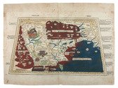
[MAP - ARABIAN PENINSULA]. PTOLEMAEUS, Claudius. [Jacobus ANGELUS, trans.; Nicolaus GERMANUS, ed.]. Sexta Asie Tabula.
Ulm, Lienhart Holle, 1482. Oblong 1mo (whole sheet: 41.5 by 57 cm). With a double-page woodcut map. Finely coloured by a contemporary hand, with near-contemporary manuscript vignette illustrations of an Ababeel bird, Makkah (Mecca) and the Kaaba in pen and wash highlighted in gold. Full description
€ 150,000
Order Inquire Terms of sale

Second map of the Arabian peninsula ever published

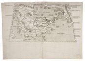
[MAP - ARABIAN PENINSULA]. PTOLEMAEUS, Claudius. Sexta Asiae tabula.
[Rome, Petrus de Turre, 1490 (engraved Rome, ca. 1478)]. Engraved map of the Arabian peninsula (topographic image 25.5 x 46 cm) printed, as usual, on two joined folio leaves (together 39.5 x 56 cm). Mounted on paper board, in a modern gilt frame (50.5 x 67 cm). Full description
€ 50,000
Order Inquire Terms of sale

One of the greatest of English travel books: the first edition of the "Pilgrimes"
together with the fourth and best edition of the "Pilgrimage" - with many extra plates

PURCHAS, Samuel. Purchas his pilgrimes. In five bookes. ...
London, printed by William Stansby for Henry Featherstone, 1625.
With:
(2) PURCHAS, Samuel. Purchas his pilgrimage ...
London, printed by William Stansby for Henry Featherstone, 1626.
2 works in 5 volumes, the first in 5 parts, 4 volumes and the second in 4 parts, 1 volume. Folio. Ad 1 with the engraved frontispiece, 5 folding engraved maps, 58 half-page engraved maps by Hondius, 2 full-page engraved plates (including 1 folding), 5 half-page engraved plates, and numerous woodcut illustrations. Further extra illustrated with 94 engravings taken from various late 16th- or early 17th-century travelogues: 1 engraved frontispiece, 1 title-page (with an engraved world map on recto and an engraved portrait of Jacob le Maire on verso), and 92 engraved maps or plates (including 48 half-page and 18 folding). Ad 2 with 1 folding engraved map of China, 1 half-page engraved illustration, and 23 half-page engraved maps by Hondius in the text. Uniform 19th-century black tooled brown morocco (by Hatton, Manchester), spines lettered in gold, gold-tooled turn-ins, marbled endpapers, gilt edges. Full description
€ 125,000
Order Inquire Terms of sale
681 books found / Show all