Categories
Shopping cart (0 items € 0)
Advanced search

Cartography & Exploration

Beautiful atlas of the Land van Voorne, in full contemporary colour

DIJCK (DYCK), Heyman van. Voorne caart-boeck van alle de dorpen, en polders gelegen inden lande van Oost, ende West Voorne, mitsgaders over Flacquée.
[Netherlands, ca. 1701]. Imperial folio (ca. 55 x 38 cm). Etched double-page title-page by Romeyn de Hooghe, dated "1701", and 32 engraved double-page maps (numbered I- VI, A-F and 1-9) engraved by Jan Stemmers and etched by Jan and Caspar Luyken after drawings by A. Steyaart, all in beautiful contemporary colouring. Contemporary red half sheepskin. Full description
€ 25,000
Order Inquire Terms of sale

Solving the mysterious disappearance of the famous explorer La Pérouse in the South Sea Islands

DILLON, Peter. Reis naar de eilanden der Zuidzee, gedurende de jaren 1827 en 1828, behelzende het verslag der ontdekking van het lot van De la Pérouse.
Amsterdam, G.J.A. Beijerinck, 1830. 2 volumes. 8vo. With 2 folding lithographed frontispieces and a folding engraved map of Vanikoro. The plates are new for this edition, lithographed by Jean Augustin Daiwaille after designs by (Pieter van der?) Meulen and based on the plates in the English edition. Contemporary stiff sprinkled paper wrappers. X, 336; VI, 350 pp. Full description
€ 2,500
Order Inquire Terms of sale

Incunable edition of an influential second century description of the antique world,
including early mentions of China and Arabia

DIONYSIUS Periegetes. [incipit :] ... de situ orbis habitabilis ...
[Colophon:] Venice, Franz Renner, 1478. Small 4to (19 x 14 cm). With the first four lines printed in red and 9 white on black decorated woodcut initials (1 series), plus 1 repeat. Set in roman type, 26 lines to a page, with two words in Greek. Modern blind-tooled calf. [36] ll. Full description
€ 35,000
Order Inquire Terms of sale

Eyewitness account of a 1570 diplomatic mission to the Ottoman court,
with 28 fine original colour drawings and samples of Turkish decorated paper

[DIPLOMATIC MISSION]. BRAECKLE, Jacques de. Memoires du voiage de Constantinople de Jacques de Bracle seigneur de Bassecourt.
[Various places, [1570 or very soon after]. 4to (main text & decorated paper) & 8vo (transcription & drawings) (21.5 x 14.5 cm). Manuscript in French, written in brown ink on paper in a Flemish bastarda gothic hand, with about 26 lines per page. With 8 contemporary half-sheet specimens of Turkish decorated "silhouette" paper (folded to make 16 leaves in 2 quires), a series of 28 drawings in brown ink and coloured gouaches, highlighted in gold (mostly costume figures, some showing the Sultan and other leading figures, others showing anonymous types from various ethnic and religious groups), plus a ca. 1800, transcript of the complete text and biography of the author (with his arms in colour). Modern sheepskin parchment. [2 blank], [34]; [5 blank], [62 incl. a few blank], [1 blank] pp. plus 8 double leaves of decorated paper and [36], [4 blank]; [2], [2 blank] pp. of 18th-century additions. Full description
€ 180,000
Order Inquire Terms of sale

Life and customs in the Ottoman Empire, described by a Christian former slave

DJURDJEVIC, Bartol (Bartholomeus GEORGIEVITZ) Voiage de la saincte cite de Hierusalem. Jointe la description des citez, villes, ports, lieux, & autres passages. Ensemble les ceremonies des Turcs ...
Liège, printed by Leonard Streel for Lambert de la Coste, 1600. 2 parts in 1 volume. 4to. 18th-century calf, gold-tooled spine. [32], [32] lvs. Full description
€ 17,500
Order Inquire Terms of sale

Travels in Siberia and China

DOBELL, Peter. Travels in Kamtchatka and Siberia; with a narrative of a residence in China.
London, Henry Colburn and Richard Bentley (back of title-page: J.B. Nichols and son), 1830. 2 volumes. 12mo. With two hand-coloured aquatint frontispieces by J. Clarck. Contemporary boards. IX, [1 blank], 351, [1]; X, 341, [1 blank], [2] pp. Full description
€ 2,250
Order Inquire Terms of sale

Highly decorative celestial chart, coloured by a contemporary hand

DOPPELMAYR, Johann Gabriel. Hemisphaerium coeli boreale in quo fixarum loca secundum eclipticae ductum ad an[n]um 1730 completum exhibentur.
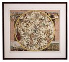
[Nürnberg, Heirs of Homann, 1742]. Engraved celestial chart (50 x 59 cm), wholly coloured by a contemporary hand. With title at the head, circular chart in the centre flanked by positional tables and views of the astronomical observatories of Tycho Brahe at Hven, at Paris, of Hevelius at Danzig and of Eimmart at Nürnberg. Framed (69 x 77 cm). Full description
€ 1,750
Order Inquire Terms of sale

Finely engraved wall map of the Rijnland water district, coloured by a contemporary hand

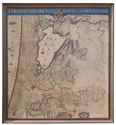
DOU, Jan Jansz. (Johannes Dou I), Steven van BROECKHUYSEN and Melchior BOLSTRA. 'T Hooge Heemraedschap van Rhynland.
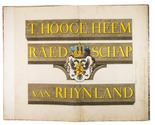
[Amsterdam, Isaak Tirion], 1746. Very large engraved wall map of the Rijnland water district in 12 map sheets and 1 title-sheet, the title-sheet divided into 3 strips, the whole mounted on cloth (measuring 185 x 169 cm as assembled). Coloured and shellacked by a contemporary hand, with gold for the lettering of the title and the coat of arms. With the water board's coat of arms, and two decorative cartouches listing the members of the water board in 1687 and 1746. Framed. Full description
€ 7,500
Order Inquire Terms of sale

Beautiful hand-coloured wall map of Rijnland

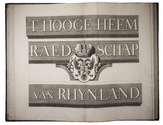
DOU, Jan Jansz. (Johannes Dou I), Steven van BROECKHUYSEN and Melchior BOLSTRA. 'T Hooge Heemraedschap van Rhynland.
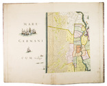
[Amsterdam], Isaak Tirion, 1746. Atlas folio (58.5 x 37.3 cm). With 15 double-page engraved plates, all coloured by hand, including 13 maps. The plate size is mostly ca. 44.5 x 55 cm and ca. 41.5 x 55 cm, the map of the Haarlemmermeer has plate size 55 x 63 cm. An illustration of existing and projected sluices for drainage of the polder and another illustration with title, both after drawings by Melchior bolstra. All plates mounted on stubs so that they open flat. Half red sheepskin and intricately marbled paper sides. Full description
€ 6,000
Order Inquire Terms of sale

Beautiful wall map of Rijnland

DOU, Jan Jansz. (Johannes Dou I), Steven van BROECKHUYSEN and Melchior BOLSTRA. 'T Hooge Heemraedschap van Rhynland.
[Amsterdam], Isaak Tirion, 1746. Atlas folio (58.5 x 37.5 cm). With 15 double-page engraved plates (plate size mostly ca. 44.5 x 55 cm and ca. 41.5 x 55 cm), including 13 maps (that of the Haarlemmermeer with plate size 55 x 63 cm), an illustration of existing and projected sluices for drainage of the polder and another illustration with title, both after drawings by Melchior Bolstra. All plates mounted on stubs so that they open flat. Half calf. Full description
€ 5,000
Order Inquire Terms of sale
650 books found / Show all