Categories
Shopping cart (0 items € 0)
Advanced search

Asia / Southeast Asia

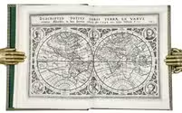
Massive navigational directory for the East
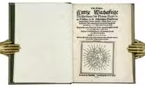
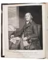
HORSBURGH, James. 
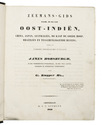
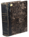
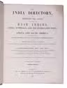
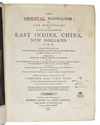
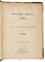
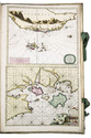
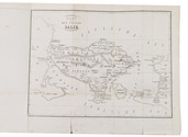
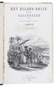
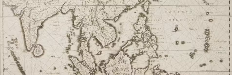
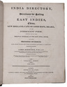
The India directory, or, directions for sailing to and from the East Indies, China, New Holland, Cape of Good Hope, Brazil, and the interjacent ports ... third edition.
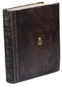
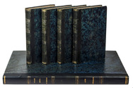
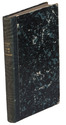
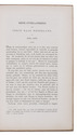
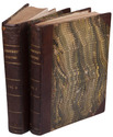
London, printed for the author and sold by Kingsbury, Parbury and Allen, booksellers to the East India Company (back of title-page: printed by Plummer & Brewis), 1826-1827. 2 volumes. 4to. Contemporary half calf, rebacked with the original backstrips laid down. [8], XXVI, 503, [1], 16; [8], 642, [1], [1 blank] pp. Full description
€ 15,000
Order Inquire Terms of sale

Massive navigational directory, with sections on the Arabian Sea, the Red Sea and the Gulf

HORSBURGH, James, Gerrit KUIJPER and D. BOES LUTJENS. Zeemans-gids, naar, in en uit Oost-Indiën, China, Japan, Australiën, de Kaap de Goede Hoop, Braziliën en tusschenliggende havens, volgens de vierde Engelsche uitgave van James Horsburgh, ...
Amsterdam, C.F. Stemler, (back of half-title: printed in Haarlem by H. Bakels), 1841. 4to. Contemporary half calf, spine lettered in gold, marbled sides. I-XII, [2], XIII-XXIV, XXVIII, 1376 pp. Full description
€ 3,750
Order Inquire Terms of sale

Updated edition of a massive directory providing essential information
for navigating in the Southern and Eastern hemispheres

HORSBURGH, James. The India directory, or, directions for sailing to and from the East Indies, China, Australia, and the interjacent ports of Africa and South America ... Seventh edition.
London, Wm. H. Allen & Co. (back of the title pages: printed by Cox and Wyman), 1855. 2 volumes. Large 4to (28 x 23 cm). Contemporary half calf, re-backed with the original backstrips laid down. XII, XXXIV, [2], “681” [= 683], [1 blank]; VIII, 978 pp. Full description
€ 18,000
Order Inquire Terms of sale

Containing the world map with the portraits of Vespucci, Drake, Cavendish, and El Cano, first Hulsius illustrated edition of Houtman’s voyage

HOUTMAN, Cornelis de and Levinus HULSIUS (translator). Erste Schiffart. Kurtze warhafftige Beschreibung der Newen Reyse oder Schiffart so die Hollendischen Schiff in den Orientalischen Indien verricht: welche Anno 1595. In Martio, alda aussgefahren und erst im Augusto des verlauffenen 1597. Jahrs wider kommen seind. Darinne der gantz Sueces der Reyse... erzehlt wird.
Nürnberg, In verlegung Levinius Hulsius [printed by Christoph Lochner], 1599. 4to. With a double-page world map, and 11 plates and maps. 19th-century gold-tooled straight-grain green morocco, with the title and author lettered in gold on the spine, an elaborate gold border on both boards, ornaments on the spine, gold-tooled turn-ins. [4], 76 pp. Full description
€ 12,500
Order Inquire Terms of sale

Important guide to navigating the seas to the far reaches of Asia

HUDDART, Joseph. The oriental navigator; or, new directions for sailing to and from the East Indies, China, New Holland, &c. &c. &c. Also for the use of the country ships, trading in the Indian and China seas, Pacific Ocean, &c. &c. &c...
London, printed and published by Robert Laurie and James Whittle, map, chart, and printsellers, 1801. 4to. With an engraved frontispiece portrait of Huddart by James Stow after John Hoppner and small woodcut coastal views in the text. Contemporary tree calf. [2], XII, 656 pp. Full description
€ 7,500
Order Inquire Terms of sale

Spectacular 18th-century Dutch composite sea atlas with 3 detailed manuscript charts,
all charts and the engraved title page expertly coloured by a contemporary hand

[KEULEN, Gerard and Johannes van, and others]. [Composite sea atlas containing 56 detailed charts including 3 manuscript charts].
Amsterdam, [Johannes van Keulen and others, 1700-1753, engraved title page dated 1734]. Large folio (61.5 x40.5 cm). With an engraved allegorical title page by Aernout Nagtegael after Jan Luyken, and 56 detailed sea charts, the whole expertly coloured by a contemporary hand. The atlas includes 22 large folding charts, including 3 highly interesting manuscript charts, 27 double-page charts, 1 full-page chart, and 6 half-page charts, most of them with beautiful cartouches, depicting views, local people, and merchandise. The maps are engraved and originally edited by the most famous Dutch cartographers and map-publishers of the late 17th- and early 18th centuries. Contemporary blind-tooled vellum, with green cloth closing ties. Title page and 56 charts. Full description
€ 495,000
Order Inquire Terms of sale

Important scientific and trade voyage around the world

LAPLACE, Cyrille Pierre Théodore. Voyage autour du monde par les mers de l'Inde et de Chine ... exécuté sur la corvette de l'état La Favorite pendant les années 1830, 1831 et 1832.
Paris, Imprimerie Royale (views volume: Arthus Bertrand; map volume: Dépôt-Générale de la Marine), 1833-1835. 4 text volumes (8vo), 1 views volume (folio) and 1 atlas volume (1mo, 66 x 51 cm). With 1 folding engraved map in the first text volume, 2 full-page maps and 10 maps on 9 double-page plates in the "atlas hydrographique", and 72 extraordinary aquatint plates (ca. 27 x 36 cm) in the "album historique", most of them with the blind-stamped image of the ship La Favorite (15 x 28 mm). Contemporary half dark green calf, gold-tooled spines. [4], XLI, 558, [2]; [4], 481, [1]; [4], 510, [2]; [4], 480; [4] pp. Full description
€ 45,000
Order Inquire Terms of sale

Journal of a 1674/75 overland voyage through India, Iran, Iraq and Syria to Amsterdam

LEEUWENSON, Joannes (Pieter Arend LEUPE, ed. & intro.). Eene overlandreis uit Indië naar Nederland, in 1674-1675.
[Amsterdam, Frederik Muller, 1863]. 8vo. Offprint, retaining the original pagination and collation, of an article in Bijdragen tot de Taal-, Land- en Volkenkunde van Nederlandsch-Indië, 6 (1863). 20th-century stiff paper wrappers, with a printed label on the front. pp. [89], 90-142. Full description
€ 1,250
Order Inquire Terms of sale
119 books found / Show all