Categories
Shopping cart (0 items € 0)
Advanced search

Asia / Cartography & Exploration

Historical narrative of a voyage to India and Persia written by a surgeon of the British Royal Navy
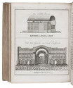
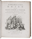
IVES, Edward. Reize naar Oost-Indië en Persië, en de daar omliggende landen. Ondernomen langs een' ongewoonen weg.
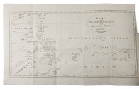
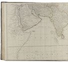
Amsterdam, De Compagnie, 1779. 2 parts in 1 volume. 4to. With 2 engraved title-pages, 2 folding engraved maps, one of India, the other tracking Ives's journey from Basra to Latakia, and 9 engraved plates (including 1 large folding). Contemporary blind-tooled vellum. [16], 324; [1], [1 blank], [1], [1 blank], 379, [1] pp. Full description
€ 3,950
Order Inquire Terms of sale

A teenage sailor’s adventures in Arabia, Mumbai and elsewhere

JAMES, Silas. A narrative of a voyage to Arabia, India; &c; ...; with remarks on the genius and disposition of the natives of Arabia Felix; ...
London, printed by William Glindon, sold by the author, [1797]. 8vo. With a frontispiece portrait of the author engraved by William Newman. Modern dark brown calf, gold-tooled spine. “VI” [= VIII], 7, [1 blank], [1], 10-232 pp. Full description
€ 8,500
Order Inquire Terms of sale

Over 200 scientific articles on Western & Central Asia and India, bound in 107 volumes

[JOURNALS – WESTERN AND CENTRAL ASIA; INDIA], Olaf CAROE, Aurel STEIN, Richard TEMPLE, Francis YOUNGHUSBAND et al. [Large collection of journal articles about the scientific exploration of Western and Central Asia and India].Including:
- Journal of the Royal Asiatic Society.
- Geographical Journal.
- Journal of the Asiatic Society of Bengal.
- Journal of the Royal Central Asian Society.
- Journal of the Royal Geographical Society.
- Transactions of the Bombay Geographical Society.
- National Geographic.
Various places, a.o. London and Calcutta, various publishers, 1837-1981. 107 volumes, many containing multiple articles. 8vo. Some illustrated with plates and maps. Half calf with marbled sides and gilt lettering on spine or cloth with marbled sides and label on spine. Full description
€ 35,000
Order Inquire Terms of sale

The most extensive, precise and complete descriptions of Java ca. 1850, beautifully illustrated

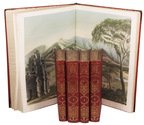
JUNGHUHN, Franz Wilhelm. Java, zijne gedaante, zijn plantentooi en inwendige bouw. ... Tweede verbeterde uitgave.
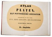
Including: JUNGHUHN, Franz Wilhelm. Atlas van platen, bevattende elf pittoreske gezigten. − Behoorende tot het werk Java, zijne gedaante, zijn plantentooi en inwendige bouw.
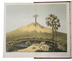
Den Haag, C.W. Mieling, 1853-1854. 4 text volumes and 1 plates volume. Large 8vo (26 x 17.5 cm: text volumes 1-4) and large folio (44 x 31.5 cm: plates volume). Each text volume with a lithographic title-page, vol. 1 with the text blue on white and vols. 2-4 with the text white on buff; the plates volume with a double-page letterpress title-page. Further with 12 double-page chromolithographed or double-tinted lithographed views: 1 as frontispiece to vol. 1 and 11 (43 x 58 cm; image 31 x 43 cm to 38 x 54 cm, 5 numbered VII, VIII, X, XI & XV) in the atlas volume; most in black, buff and blue and at least most drawn by Junghuhn and lithographed by Mieling (all but the frontispiece signed by the latter), and 51 black and white lithographic plates (45 folding) with topographic maps, views, cross-sections, etc. Contemporary half red sheepskin(?), (text vols.) and goatskin morocco (atlas vol.), gold-tooled spines. Bound by Hendrik Willem Ywema (1828-1905) in Utrecht. 16, VIII, 17-671; XII, 538; 539-1432; VIII, 498 pp. plus title-pages & plates. Full description
€ 32,500
Order Inquire Terms of sale

The main source of early knowledge of the Pelew or Palau Islands in Micronesia, in Dutch translation

KEATE, George. Beschryving van de Pelew Eilanden ...
Rotterdam, Gerard Abraham Arrenberg, 1789. 4to. With 8 plates: 4 mixed technique (partly stipple-engraved) portraits, 1 large folding engraved map of the Palau Islands and western equatorial Pacific, and 3 folding engraved views. Contemporary boards. XXXII, 365, [1] pp. Full description
€ 2,500
Order Inquire Terms of sale

Spectacular 18th-century Dutch composite sea atlas with 3 detailed manuscript charts,
all charts and the engraved title page expertly coloured by a contemporary hand

[KEULEN, Gerard and Johannes van, and others]. [Composite sea atlas containing 56 detailed charts including 3 manuscript charts].
Amsterdam, [Johannes van Keulen and others, 1700-1753, engraved title page dated 1734]. Large folio (61.5 x40.5 cm). With an engraved allegorical title page by Aernout Nagtegael after Jan Luyken, and 56 detailed sea charts, the whole expertly coloured by a contemporary hand. The atlas includes 22 large folding charts, including 3 highly interesting manuscript charts, 27 double-page charts, 1 full-page chart, and 6 half-page charts, most of them with beautiful cartouches, depicting views, local people, and merchandise. The maps are engraved and originally edited by the most famous Dutch cartographers and map-publishers of the late 17th- and early 18th centuries. Contemporary blind-tooled vellum, with green cloth closing ties. Title page and 56 charts. Full description
€ 600,000
Order Inquire Terms of sale

Richly illustrated and influential 17th-century book on China

KIRCHER, Athanasius. Tooneel van China.
Amsterdam, Johannes Janssonius van Waesberge and the widow of Elizaeus Weyerstraten, 1668. Folio. With engraved frontispiece, engraved author's portrait, 24 engraved plates (including 2 double-page maps and 1 folding plate) and 60 engraved illustrations in text (plus another copy on a separate leaf, without letterpress text, of the engraving on 2F3v). Including maps of China and Asia, traditional Chinese costumes, illustrations of the Chinese and the Mughal rulers in abundantly decorated rooms, linguistic illustrations, zoological illustrations, etc. Contemporary gold-tooled calf, later endpapers (re-cased). [12], 286, [10] pp. Full description
€ 8,000
Order Inquire Terms of sale

World atlas including one 6-sheet and eleven 4-sheet wall maps

KITCHIN, Thomas and others. Kitchin's general atlas, describing the whole universe.
London, Robert Laurie, James Whittle, 1808. Imperial folio (53 x 39.5 cm). With 28 engraved maps (numbered in 41 parts) assembled from 67 sheets. Most include elaborate cartouches with pictorial decoration. With the maps coloured in outline. Contemporary half calf. 1 leaf plus maps. Full description
€ 18,000
Order Inquire Terms of sale

The first Russian circumnavigation

KRUSENSTERN, Adam Johann Crusius von. Voyage autour du monde, fait dans les années 1803, 1804, 1805 et 1806, par les ordres de Sa Majesté Impériale Alexandre Ier, empereur de Russie, sur les vaisseaux la Nadiejeda et la Neva, commandés par M. de Krusenstern, capitaine de vaisseau de la marine impériale.
Paris, Librairie de Gide et Fils, 1821. 2 text volumes and 1 atlas. 8vo and folio atlas. With 30 engraved plates (21 views and portraits, 9 maps and charts, of which 3 folding). Contemporary blind-tooled dark green goatskin, with a dark green morocco title label and a dark green morocco volume label on the spine, dark green buckram sides, marbled end papers. The atlas in contemporary gold- and blind-tooled dark green quarter goatskin, with the title lettered in gold on the spine, blue green cloth sides, marbled end papers. XII, 418, [2 blank]; [2 blank], [4], 531, [1 blank]; [4] pp. + 30 plates. Full description
€ 40,000
Order Inquire Terms of sale

Travels through the Middle East, India and Europe, with 34 woodcut illustrations, including several trees

LA BOULLAYE LE GOUZ, Francois de. Les voyages et observations du sieur de la Boullaye-le-Gouz gentil-homme Angevin...
Paris, Francois Clousier, 1653. 4to. With a woodcut and an engraved author's portrait, 34 woodcut illustrations in text, including several full-page, and some woodcut initals, head- and tailpieces. Contemporary calf, gold-tooled spine. [16], 540, [10], [2 blank] pp. Full description
€ 18,000
Order Inquire Terms of sale
170 books found / Show all