Categories
Shopping cart (0 items € 0)
Advanced search

Asia / Cartography & Exploration

14th-century tales of travels in Turkey, the Middle East, Near East, India and the East Indies,
illustrated with about 60 woodblocks

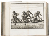
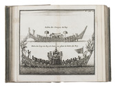
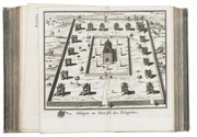
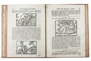
MANDEVILLE, John [= Jehan d'OUTREMEUSE]. The voyages & travels of Sir John Mandevile, Knight, ... to the Holy Land, and to Hierusalem: as also to the lands of the Great Caan, and of Prestor John: to Inde, and divers other countries: ...
London, Richard Chiswell, Benjamin Walford, Matthew Wotton, George Conyers, 1696. 4to. With a woodcut ship on the title-page and about 60 woodcut illustrations in the text (mostly about 5.5 x 8 cm) plus about 10 repeats. Gold-tooled, red goatskin morocco by Robert Riviere in London (ca. 1875/80), one of England's best binders. [4], “139” [= 135], [5] pp. Full description
€ 22,500
Order Inquire Terms of sale

Ottoman map of Iraq, Kuwait and southwestern Iran, used by its army in World War I

[MAP - OTTOMAN ARMY]. [Iraq, Kuwait and Iran].
Istanbul, [Erkan-i Harbiye-i Umumiye], 1331 Rumi [= 1915 CE]. Colour-lithographed map of Iraq, Kuwait and southwestern Iran (65.5 x 66 cm) in black, brown, blue and green at a scale of 1:1,000,000, dissected into 12 sections and mounted on contemporary cloth. Full description
€ 3,500
Order Inquire Terms of sale

Poetic descriptions of Batavia, India, the Cape, Dutch country estates and notable persons

MARRE, Jan de. Batavia, begrepen in zes boeken.
Amsterdam, Adriaan Wor & heirs of G. onder de Linden, 1740.
With:
(2) MARRE, Jan de. Bespiegelingen over gods wysheid in't bestier der schepselen, en eerkroon voor de Caab de Goede Hoop.
Amsterdam, Adriaan Wor & heirs of G. onder de Linden, 1746.
(3) MARRE, Jan de. Hof- en mengeldichten.
Amsterdam, Adriaan Wor & heirs of G. onder de Linden, 1746.
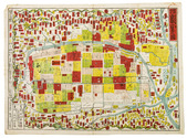
3 works in 1 volume, the first in 6 parts. 4to. With an engraved frontispiece and an elaborate title-vignette (identical on all three title-pages. And ad. 1 with a folding engraved plate of Jakarta "as it was in 1731" by Jan van der Laan. Contemporary vellum, red spine label. [36], 320, [6]; [42], 178, [22], [20], 214, [4] pp. Full description
€ 1,500
Order Inquire Terms of sale

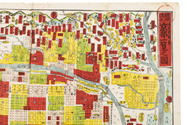
First edition of a report - with the rare folding map - from Commodore Perrys expedition containing directions for U.S. merchant ships navigating the coasts of China and Japan

MAURY, William Lewis & Silas BENT. Sailing directions and nautical remarks; by officers of the late U.S. naval expedition to Japan, under the command of Commodore M.C. Perry.
Including (with a divisional title): Fac-simile of the original treaty with Japan, with the English version.
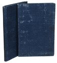
Washington, A.O.P. Nicholson, public printer, 1857. Large 4to (ca. 29.5 x 23 cm). With a large folding map of the coast of China and of the Japanese and other islands, including the Marianas and the Philippines; and the facsimile of the 14-page treaty in Japanese printed on both sides of 7 integral leaves, with the English text printed letterpress on both sides of the following leaf. Original publishers half purple cloth, Spanish-marbled paper sides (grey with red, blue, black, yellow and white veins), letterpress paper label with the title in a built-up decorative border on the front board: "Sailing directions for the coasts of Japan and China". 22, [2], 14, [2] pp. Full description
€ 5,000
Order Inquire Terms of sale

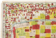
A Swedish edition of John Meares's voyages to the North Pacific, China and Hawaii

MEARES, John. Tvänne resor från Ostindien till Americas nordvåstra kust, åren 1786, 1788 och 1789.
Stockholm, printed by J.S. Ekmanson for I. Utters, 1797. 8vo. 19th-century half scheepskin, gold-tooled spine with red morocco title label, marbled sides. [12], 404 pp. Full description
€ 1,250
Order Inquire Terms of sale

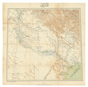
Highly detailed maritime atlas

GREAT BRITAIN METEOROLOGICAL OFFICE. Monthly current charts for the Indian Ocean. From information collated & prepared in the Meteorological Office.
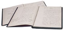
London, Admiralty Hydrographic Office, under the superintendence of Rear-Admiral W. J. L. Wharton, 1895-1896. Plano. Oblong Royal 1mo (full-sheet leaves: 51 x 62 cm). An atlas of 12 large black and white nautical charts. Limp cloth with gold-tooled title on front cover. [12] ll. plus the 1-page “Advertisement”. Full description
€ 3,500
Order Inquire Terms of sale

Shipwreck of the Fattysalam off the coast of Coromandel

[MEUSNIER DE QUERLON, Anne-Gabriel]. [Half-title:] Naufrage et retour en Europe de monsieur de Kearny.
[Paris?, the author?, 1764?]. 8vo. With a headpiece built up from Fournier's rococo cast fleurons. Set in Fournier types, including decorated titling capitals. 20th-century decorated paper wrappers in lavendar, green and brown, red sprinkled edges. 48 pp. Full description
€ 3,500
Order Inquire Terms of sale
164 books found / Show all