Molluscs collected by the Prince of Monaco during expeditions to the northern Atlantic
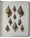
[ALBERT I of Monaco]. DAUTZENBERG, Philippe & Henri FISCHER.
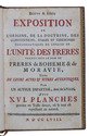
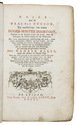
Mollusques provenant des campagnes de l'Hirondelle et de la Princesse-Alice dans les Mers du Nord.
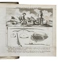
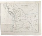
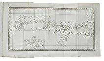
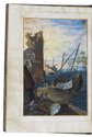
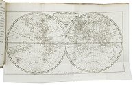
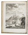
Monaco, Imprimerie de Monaco, 1912. Large 4to (34 x 26.5 cm). With 2 maps and 11 coloured plates. Modern cloth. [3], [1 blank], 629, [1 blank], [1] pp. Full description
€ 600
Monaco, Imprimerie de Monaco, 1912. Large 4to (34 x 26.5 cm). With 2 maps and 11 coloured plates. Modern cloth. [3], [1 blank], 629, [1 blank], [1] pp. Full description