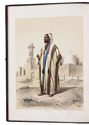
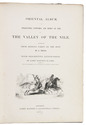
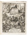
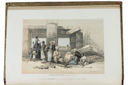
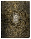
Magnificent de luxe issue, with 31 hand-coloured lithographs
PRISSE D'AVENNES, Achille Constant Théodore Émile.
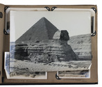
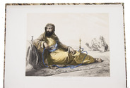
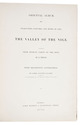
Oriental album. Characters, costumes, and modes of life, in the valley of the Nile.
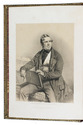
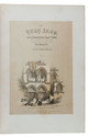
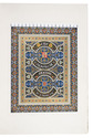
London, James Madden, 1848. Imperial folio (52.5 x 37.5 cm). With an additional decorative title-page, separately chromolithographed in black, gold and 7 colours, tinted and hand-coloured lithographed frontispiece portrait of the dedicatee, and 30 tinted and hand-coloured lithographs. Numerous wood-engraved illustrations in the text. Modern half calf, richly gold-tooled spine. [6], 60 pp. Full description
€ 65,000
London, James Madden, 1848. Imperial folio (52.5 x 37.5 cm). With an additional decorative title-page, separately chromolithographed in black, gold and 7 colours, tinted and hand-coloured lithographed frontispiece portrait of the dedicatee, and 30 tinted and hand-coloured lithographs. Numerous wood-engraved illustrations in the text. Modern half calf, richly gold-tooled spine. [6], 60 pp. Full description