Categories
Shopping cart (0 items € 0)
Advanced search

Africa / East & Southern Africa

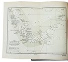
Ship's journal from Seychelles and Madagascar,
with numerous maps and earlier illustrated anatomical lecture notes
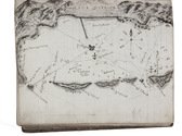
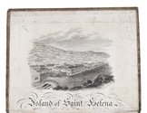
[MANUSCRIPT - SHIP'S JOURNAL]. MORSE, Edward George. A journal of remarks and observations as kept by E. G. M. . ..
[mostly on board the barque Sarah of London], April 1831-14 March 1833 (with additions to 1835). with an engraved view as frontispiece, 15 full-page, 1 nearly full-page and 1 smaller manuscript maps and coastal profiles, plus a small engraved view ("Tomb of Napoleon") mounted on 1 page.
Including: MORSE, Edward George. Lecture Book [notes on anatomical lectures by Joseph Constantine Carpue].
[London], November-December 1828. with a matching pair of engravings of a scull on and facing the title-page, and 27 pencil and/or ink anatomical drawings (including 2 full-page), some also with red. 4to (19.5×16.5 cm). Contemporary sheepskin parchment. [191] ll. Including paste-downs and about 55 blanks. Full description
€ 35,000
Order Inquire Terms of sale

Official publications concerning the British and German claim on Angra Pequena (Lüderitz), Namibia

[NAMIBIA - AFRICA]. Angra Pequena. Correspondence respecting the settlement at Angra Pequena, on the S.W. coast of Africa. ... [C.-4190].
With:(2) Copy of a despatch from the Right Honourable the Earl of Derby, K.G., Her Majesty's high commissioner in South Africa, relative to the establishment of a German protectorate at Angra Pequena and along the neighbouring coast. ... [C.-4265].(3) Further correspondence respecting the settlement at Angra Pequena on the south-west coast of Africa (in continuation of [C.-4190] ...) ... [C.-4262].
London, Eyre and Spottiswoode, 1884. 3 works in 1 volume. Folio. With a folding map in ad 1 and a full-page map in ad 3. Modern blue paper wrappers. X, 60; 13, [1]; X, 75, [1 blank] pp. Full description
€ 750
Order Inquire Terms of sale

Navigating the Red Sea and Gulf of Aden

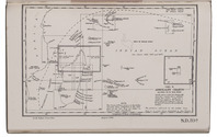
[NAVIGATION - RED SEA]. Red Sea and Gulf of Aden pilot comprising the Suez canal, the gulfs of Suez and 'Aqaba, the Red Sea, the Gulf of Aden, ...
Including: Supplement no. 1-1957 relating to the Red Sea and Gulf of Aden pilot, tenth edition ...
London, published by the Hydrographic Department, Admiralty, 1955-1957. 8vo. With a folding map (printed on both sides), 2 coloured plates with diagrams (printed on both sides), 28 plates showing coastlines and occasionally a map (many printed on both sides), and many some illustrations in text. Original blue cloth; supplement with original printed paper wrappers. LI, [1 blank], 518, [1], [1 blank] pp. Full description
€ 1,750
Order Inquire Terms of sale

First Dutch edition of Niebuhr's detailed and extensively illustrated description of his travels
in Arabia and surrounding regions

NIEBUHR, Carsten. Reize naar Arabië en andere omliggende landen.
Amsterdam, S.J. Baalde; Utrecht, J. van Schoonhoven & Comp. (vol. 1) and Bartholomeus Wild (vol. 2) (colophons: printed in Utrecht by Johan Joseph Besseling), 1776-1780. 2 volumes. 4to (27.5 x 22 cm). With 2 engraved title-pages, each with the same vignette, 35 maps and plans (9 folding and the large map of Yemen coloured by hand in red and green outlines), 21 views (12 folding) and 69 other illustrations (19 folding) of people, sculptures and examples of ancient script, engraved by C. Philips, Th. and C.H. Koning, C.J. de Huyser, C.F. Fritsch, C. Brouwer and others. Half calf, sprinkled paper sides, gold-tooled spine with a red title label with gold lettering. VIII (I and III blank), [6], 484, [2]; [1], [1 blank], [1], [1 blank], [12], 455, [1] pp. Full description
€ 5,000
Order Inquire Terms of sale

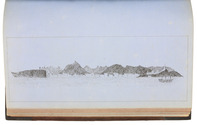
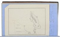
Manuscript log of a voyage from Suez through the Red and Arabian Seas to Bombay, Karachi and Colombo, with 8 excellent nautical charts and 5 beautiful sketches, including one of the city of Muscat

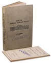
[OMAN NAVIGATION LOGBOOK]. MCKINNELL, Thomas, assistant master. Log of the proceedings. HMS "Cyclops". W. J. S. Pullen Esq. Captain. Commencing Monday 7th February 1859, ending Wednesday 22nd of May, 1861. Kept by Thos. McKinnell, Mast. Asst.
HMS Cyclops: Oman, Khuriya Muriya Islands, Yemen, Egypt, Red Sea, Arabian Sea, Pakistan, Sri Lanka and other places, 1857-1861. Folio (20 x 31.5 cm). Over 360 pp. of manuscript entries, written with brown ink in a legible hand on watermarked laid paper with a blue cast. With 8 pen and ink nautical charts and 5 sketches of coastal sites, including the city of Muscat (8 on the logbook pages and 5 on separate thick album leaves). Contemporary brown cloth over boards, rebacked in period-style black calf with the spine lettered in gold: "Log H.M.S. Cyclops". [ca. 360], [32 blank] pp. Full description
€ 45,000
Order Inquire Terms of sale

The first publication of the Ethiopic Genesis

OTHO, Georg. Palaestra linguarum orientalium, hoc est: quatuor primorum capitum Geneseos, I. Textus originalis tam ex Judaeorum quàm Samaritanorum traditionibus. II. Targumim seu paraphrases orientales praecipuae, nempe I. Chaldaicae, (Onkelosi, Jonathanis et Hierosolymitana) II. Syriaca, III. Samaritana, IV. Arabica, V. Aethiopica, VI. Persica. Omnia cum versione Latinâ ...
Including: OTHO, Andreas. Glossarium linguarum orientalium octuplex: Hebraicum, Chaldaicum, Syriacum, Samaritanum, Arabicum, Aethiopicum, Persicum et Rabbinicum ...
Frankfurt am Main, published by Friedrich Knoch, printed by Martin Jacquet, 1702. 4to. With one woodcut initial. Set in roman, Arabic, Hebrew, Samaritan and Ethiopic types. 2 parts in 1 volume. Nineteenth-century half calf with marbled sides. [18] 140, 147, [3] pp. Full description
€ 3,950
Order Inquire Terms of sale

Probably the first manual for the use of chronometers at sea

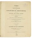
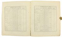
OWEN, William Fitzwilliam (ed.) & Richard OWEN. Tables of latitudes, and longitudes by chronometer, of places in the Atlantic and Indian Oceans; principally of the west and east coast of Africa, the coasts of Arabia, Madagascar. &c. resulting from the observations of H.M.S. Leven and Barracouta, in the years 1820 to 1826 inclusive, ... To which is prefixed an essay on the management and use of chronometers ...
London, George Duckworth and William Ireland, 1827. 4to. Contemporary blue boards for the Danish Navy Library, later backed with cloth. [2], 33, [3], 16, [36], 8 pp Full description
€ 2,500
Order Inquire Terms of sale

One of the earliest sources on the Congo and central Africa, complete with all plates and maps

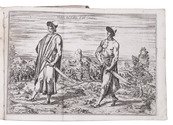
PIGAFETTA, Filippo and Duarte LOPEZ. Relatione del reame di Congo et delle circonvicine contrade tratta dalli scritti & ragionamenti di Odoardo Lopez.
Rome, Bartolomeo Grassi, [1591]. 4to. With an integral engraved architectural title-page (with the coat of arms of the dedicatee Antonio Migliore, Bishop of San Marco), large folding engraved general map of Africa (64×44 cm), large folding engraved map of the Congo (43.5×51.5 cm) and 8 numbered folding engraved plates of plants, animals and inhabitants of the country, by Natalis Bonifazio. Contemporary limp sheepskin parchment. [8], 82, [1], [1 blank] pp. Full description
€ 60,000
Order Inquire Terms of sale

The British admiralty’s pilot guide for the South Indian Ocean

[PILOT GUIDE]. South Indian Ocean pilot. Comprising Madagascar, Iles Comores, Ile de la Réunion, Mauritius, the Seychelles, the Chagos Archipelago, and other islands lying westward of longitude 80° East. Sixth edition.
London, hydrographic department, admiralty (colophon: printed by Butler & Tanner), 1946. 8vo. With two maps, to be used as an index, 10 plates and a few illustrations in text. Publisher's beige cloth.
With: Supplement no. 5-1956 relating to the South Indian Ocean pilot sixth edition, 1946 corrected to 23 April, 1956.
London, hydrographic department, admiralty (colophon: printed by Tinlling & Co., Liverpool), 1946. 8vo. With a loosely inserted folding plate illustrating the system of buoyage. Publisher's wrappers. XXX, 403, [1]; 46 pp. Full description
€ 750
Order Inquire Terms of sale

Portuguese classic of practical navigation, with 36 maps and nautical charts

PIMENTEL, Manuel. Arte de navegar, em que se ensinão as regras praticas, e os modos de cartear, e de graduar a Balestilha por via de numeros, e muitos problemas uteis aì navegação, e roteiro das viagens, e costas maritimas de Guineì, Angola, Brazil, Indias, e Ilhas Occidentaes, e Orientaes ...
Lisbon, Miguel Manescal da Costa, 1762. Folio (30 x 20.5 cm). With 21 engraved plates (1 folding), 1 nearly full-page engraving of a compass rose and about 10 woodcut diagrams in the text. Contemporary or near contemporary tanned sheepskin, richly gold-tooled spine, new endpapers. [12], 603, [1] pp. Full description
€ 5,000
Order Inquire Terms of sale
87 books found / Show all