Discovery of the Canary Islands in classical Greek and Roman, Arabic and Portuguese sources
MACEDO, Joaquim José da Costa de.
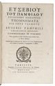
Memoria em que se pertende provar que os Arabes não conhecerão as Canarias antes dos Portuguezes.
Lisbon, printing office of the Academia Real das Sciencias, 1844. Folio. With a woodcut Portuguese coat of arms on the title-page. Modern brown paper wrapper. [4], 232 pp. Full description
€ 1,500
Lisbon, printing office of the Academia Real das Sciencias, 1844. Folio. With a woodcut Portuguese coat of arms on the title-page. Modern brown paper wrapper. [4], 232 pp. Full description