Categories
Shopping cart (0 items € 0)
Advanced search

Africa

One of the greatest of English travel books: the first edition of the "Pilgrimes"
together with the fourth and best edition of the "Pilgrimage" - with many extra plates

PURCHAS, Samuel. Purchas his pilgrimes. In five bookes. ...
London, printed by William Stansby for Henry Featherstone, 1625.
With:
(2) PURCHAS, Samuel. Purchas his pilgrimage ...
London, printed by William Stansby for Henry Featherstone, 1626.
2 works in 5 volumes, the first in 5 parts, 4 volumes and the second in 4 parts, 1 volume. Folio. Ad 1 with the engraved frontispiece, 5 folding engraved maps, 58 half-page engraved maps by Hondius, 2 full-page engraved plates (including 1 folding), 5 half-page engraved plates, and numerous woodcut illustrations. Further extra illustrated with 94 engravings taken from various late 16th- or early 17th-century travelogues: 1 engraved frontispiece, 1 title-page (with an engraved world map on recto and an engraved portrait of Jacob le Maire on verso), and 92 engraved maps or plates (including 48 half-page and 18 folding). Ad 2 with 1 folding engraved map of China, 1 half-page engraved illustration, and 23 half-page engraved maps by Hondius in the text. Uniform 19th-century black tooled brown morocco (by Hatton, Manchester), spines lettered in gold, gold-tooled turn-ins, marbled endpapers, gilt edges. Full description
€ 125,000
Order Inquire Terms of sale

A kind Muslim, an English mummy snatcher and John Smith before Pocahontas

[PURCHAS, Samuel], John SANDERSON, Henry TIMBERLAKE and others. Seer gedenckwaerdige vojagien, van Johan Sanderson, Hendrick Timberly, en Capt. Johan Smith, door Europa, Asia en America. ...
Amsterdam, Joachim van Dyck, 1678. 4to. With engraved title-page, letterpress title-page with a woodcut floral ornament, 4 folding engraved illustration plates (including 1 with 4 small views). 18th-century half vellum. [12], 158 pp. including integral frontispiece. Full description
€ 4,500
Order Inquire Terms of sale

Essential information for navigating the coasts of Africa, South America and the islands
in the expansive South Atlantic Ocean

PURDY, John (Alexander George FINDLAY ed.). The new sailing directory for the Ethiopic or Southern Atlantic Ocean; including the coasts of Brasil, etc., to the Rio de La Plata, the Coast Thence to Cape Horn, and the African Coast to the Cape of Good Hope, etc.; including the islands between the two coasts.
London, printed for R.H. Laurie by J. Rider, 1844. 8vo. With Lauries RHL device on the title-page, and 32 small images in the text, mostly coastal profiles. The title-page includes some lines in sans-serif capitals. Half cloth. XLIV, 472 pp. Full description
€ 1,950
Order Inquire Terms of sale

275 photographic views and portraits, mostly made in Iraq 1928 to 1933

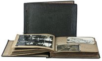
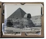
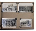
[PHOTOGRAPHS - IRAQ]. REYNISH, William. [Views, scenes, monuments, airplanes, military vehicles, British troops and local inhabitants].
[Iraq (plus Malta and Egypt), ca. 1928-1933]. Oblong albums (25 x 34.5 cm & 21.5 x 28.5 cm). Two albums containing about 275 silver halide photographic gelatin prints (6 x 8.5 cm to 16 x 21.5 cm) assembled and mostly taken by a British Royal Air Force pilot while stationed in Iraq and then briefly Malta, with a visit to Egypt. The photos mounted with paper corner-mounts in two contemporary cloth-covered albums, the larger with padded boards covered in alligator-skin patterned dark green cloth, with the photographs on both sides of 24 dark grey album leaves, each leaf with a glassine paper guard-leaf (embossed with a spider-web pattern) bound in before it; the smaller covered in black cloth with a grey-white bird in a cloud painted on the front board and the word "snaps", with the photographs on both sides of leaves 2-35 & 51-52 of 54 light brown album leaves. Full description
€ 8,500
Order Inquire Terms of sale

The British Consul of Zanzibar and his strenuous attempts to put a stop
to the business of slavery in the Sultanate

RIGBY, Colonel Christopher Palmer; Lilian M. RUSSELL-RIGBY (ed.). General Rigby, Zanzibar and the slave trade with journals, dispatches, etc.
London, George Allen & Unwin Ltd, 1935. 8vo. With a folding "Rough sketch-map to illustrate General Rigbys career in H.M. Service" (ca. 25 x 29 cm) and the half-page coat-of-arms of Rigby on p. [5]. Original publisher's blue cloth with a blind-stamped centrepiece on the front board and the title in gold on the spine, covered with the original blue publisher's paper wrappers, protected by a plastic wrapper. [10], 15-404, [4] pp. Full description
€ 475
Order Inquire Terms of sale

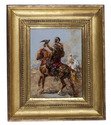
Fantastic (partly true?) adventures in Ottoman Africa, by an English merchant captured by Barbary pirates in 1648

ROBERTS, A. The adventures of (Mr T. S.) an English merchant, taken prisoner by the Turks of Argiers, and carried into the inland countries of Africa.
London, Moses Pitt [printed by William Wilson?], 1670. Small 8vo. Blind- and gold-tooled calf (ca. 1800). [8], "252" [= 254], [2] pp. Full description
€ 9,500
Order Inquire Terms of sale

Stunning double-tinted views of the Middle East, after drawings made in 1838 and 1839,
with 250 plates

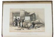
ROBERTS, David, George CROLY and William BROCKEDON. The Holy Land, Syria, Idumea, Arabia, Egypt & Nubia.
London, Day & son (vol. 3: New York, D. Appleton & Co.), 1855-1856. 6 volumes bound as 3. Imperial 8vo (30 x 22 cm). With 250 numbered plates (including 6 tinted lithographed title-pages, 2 stone-engraved maps and 239 tinted and double-tinted lithographed and 2 chromolithographed views). Contemporary, richly gold-tooled reddish-brown morocco, gold-tooled turn-ins, marbled endpapers, gilt and gauffered edges. With thin paper guard leaves facing each plate. Full description
€ 18,000
Order Inquire Terms of sale

Egypt and Nubia in 45 early drawings and squeezes, preserving images of sculptures and inscriptions

[DRAWINGS - EGYPT]. ROBERTSON, William. Egypt & Nubia.
Cairo [and elsewhere in Egypt and Nubia], 1838-1839. Folio (48 x 36.5 cm). Album containing 42 pencil and other drawings (a few partly coloured) and 3 squeezes, some on the album leaves and some loosely inserted, mostly of ancient Egyptian and Nubian architecture, sculpture, bas-reliefs and hieroglyphic inscriptions, but also with a few botanical drawings and landscapes with buildings. Most have English-language captions in brown ink and are signed and dated 1838 to 1839. New black half morocco, using mid-19th-century marbled paper for the sides. [37] ll. including title-leaf and 7 blanks, plus 16 loosely inserted ll. [37] ll. including title-leaf and 7 blanks, plus 16 loosely inserted ll. Full description
€ 45,000
Order Inquire Terms of sale

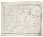
Sailing routes in the Indian Ocean and a general information about its weather, currents, etc. forecast,
with 2 maps showing the Persian Gulf, Red Sea and Gulf of Aden

ROSSER, William Henry. Short notes on the winds, weather, & currents, together with general sailing directions and remarks on making passages; to accompany a chart of the Indian Ocean.
London, James Imray & son, 1878. 8vo. With 2 folding maps. Original publishers blue wrappers. [4], 71 pp. Full description
€ 1,800
Order Inquire Terms of sale

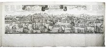
The great Lisbon earthquake of 1755 and the city of Augsburg: a splendid publication with more than 100 engraved maps, plans and views, in an Augsburg gold-brocade paper wrapper

ROTH, Johann Michaël. Augsburgische Sammlung derer wegen des höchstbetrübten Untergangs der Stadt Lissabon, ... anbey hat man die Stadt Augsburg in Grundriß mit 48. Prospecten der schönsten Gebäude denselben mit beygefüget ...
Augsburg, Johann Michael Roth, [ca. 1756].
Including:
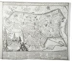
(2) [MAP - GERMANY - AUGSBURG]. KRAUS, Johann Thomas. Accurata recens delineate ichnographia ... metropolis Augustae Vindelicorum ... = Neu verfertigt accurater Grund Riß der ... Statt Augspurg, ...
Augsburg, Matthäus Seutter, [ca. 1750]. Large engraved map on a folding sheet (50 x 61 cm) at a scale of about 1:4000.
(3) WEYERMANN, Jakob Christoph. Prospectus praecipuorum aedificorum et locorum intra et extra urbem Augustam Vindelicorum ...
Augsburg, Matthäus Seutter, 1742. 4 large uncut folding sheets (each 40 x 70 cm) containing the engraved title-page in an elaborately decorated cartouche and 47 engraved views of buildings in and around Augsburg (each 16 x 13.5 cm), numbered [I], II-XLIII.
1mo (50 x 38.5 cm). With an engraved title-page, the title in the arched doorway of an architectural ruin with a female figure with the Portuguese coat of arms in mourning on the steps, flanked by 2 putti; an engraved report on the earthquake and resulting tsunami on 1 November 1755; and in the first part 60 engraved views, maps and plans printed from 25 copperplates on 13 leaves (4 large folding, including 1 constructed from 2 sheets, the rest on both sides of 9 leaves, except the last, which is blank on the reverse). Gold on black gold brocade paper wrapper, probably from the publisher, sewn without supports at 3 stations, each wrapper made from a whole sheet of the decorated paper, with as centrepiece a statue in a domed gazebo, the dome carried by 4 visible (probably of 6) caryatids. The sheet is further filled with scrollwork decoration with oval portraits in the upper corners, winged angels in the lower corners, 4 more angels plus 2 faces in the scrollwork. Pasted in the centre of the front wrapper is an engraving of the Augsburg pine cone flanked by Neptune with his trident and a river God with an oar, above a city view with cornucopias (10 x 6.5 cm), with a manuscript label below it, "1755 et 1756." The whole is kept is a finely produced modern tanned sheepskin box with the form of a book, the spine with 7 raised bands and a red morocco label, a single brass fastening, and the interior and what would be the edges of the paper lined with marbled paper combining Stormont, zebra and Spanish patterns. [20] engraved ll., some printed on both sides. Full description
€ 47,000
Order Inquire Terms of sale
267 books found / Show all