Categories
Shopping cart (0 items € 0)
Advanced search

Cartography & Exploration / Navigation

Fine untrimmed copy of a pilot guide, with coloured maps and aquatint profiles
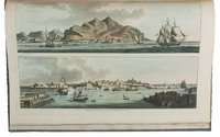
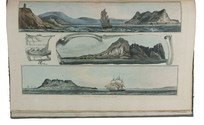
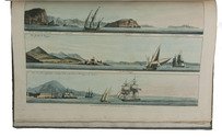
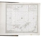
BOUGARD, René and John Thomas SERRES. The little sea torch: or, true guide for coasting pilots.
London, J. Debrett for the "author" [Serres], G. & W. Nicol, et al. [printed by T. Rickaby], 1801. Large folio (47 x 30 cm). With 20 numbered aquatint plates containing 137 coastal profiles, and 12 partly numbered engraved plates containing 24 maps of port cities, harbours, islands and the Strait of Gibraltar. All coastal profiles and maps beautifully and subtly coloured by a contemporary hand. Contemporary boards. VI, 144, [5] pp. Full description
€ 14,500
Order Inquire Terms of sale

Navigation and astronomical research in present-day Canada

CHABERT, Joseph Bernard. Voyage fait par ordre du Roi en 1750 et 1751, dans l'Amérique septentrionale, pour rectifier les cartes des côtes de l'Acadie, de l'Isle Royale & de l'Isle de Terre-Neuve; et pour en fixer les principaux points par des observations astronomiques.
Paris, Imprimerie Royale, 1753. 4to. With an engraved printer's vignette on the title-page, an engraved headpiece at the beginning of the first chapter, 6 folding engraved maps, a folding engraved plate showing geometrical figures, and a large folding table with calculations for the position of the sun and the moon. Contemporary gold-tooled red morocco. [2], VIII, 288, [10] pp. Full description
€ 12,500
Order Inquire Terms of sale

North-West Passage not through Hudson Bay

ELLIS, Henry. Reize naar de baai van Hudson, ter ontdekkinge van eenen Noord-wester doortogt, gedaan in de jaaren 1746. en 1747.
Leiden, Elie Luzac jun., 1750. 8vo. With large folding engraved map (18 x 44.5 cm), and 9 engraved plates, mostly folding by N. van Frankendaal, with captions in French and Dutch. Contemporary red half roan. XXXII, 440 pp. Full description
€ 2,950
Order Inquire Terms of sale

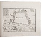
Europe fortified: the fortifications of Marolois, Stevin and Vauban, beautifully mapped,
together with an atlas of the coasts of France, also with fortifications

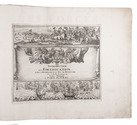
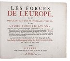
FER, Nicolas de. Les forces de l' Europe, ou description des principales villes; avec leurs fortifications. . . .
Paris, "chez l'auteur" [=Nicolas de Fer, a false imprint], 1695-1696 [printed in Amsterdam, for Pieter Mortier, 1695-ca. 1702]. 10 parts in 1 volume. With 234 beautifully engraved plates (a few folding) with 366 maps and views of fortified cities.
With: (2) FER, Nicolas de. Costes de France, sur l' ocean & sur la Mer Mediterranée &c. avec leurs fortifications. . . .
Paris, "Nicolas de Fer" [a false imprint], 1695. [printed in Amsterdam, for Pieter Mortier]. With engraved title-page and 40 engraved plates (including 2 folding). 2 works in 12 parts or volumes, bound as 1 volume. Oblong 1mo (30×37 cm). Contemporary tanned sheepskin, gold-tooled spine. Full description
€ 17,500
Order Inquire Terms of sale

A standard navigational directory for the Indian Archipelago

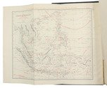
FINDLAY, Alexander George. A directory for the navigation of the Indian archipelago and the coast of China, from the Straits of Malacca and Sunda, and the passages east of Java, to Canton, Shanghai, the Yellow Sea, and Korea. With the descriptions of the winds, monsoons, and currents, and general instructions for the various channels, harbours, etc. Third edition.
London, Richard Holmes Laurie, 1889. Royal 8vo. With 11 folding maps and charts. Original publishers blindstamped cloth, lettered in gold. XLVIII, IV, 1478; [2], 8 pp. Full description
€ 2,500
Order Inquire Terms of sale

Testing chronometers by Harrison's leading French rival

FLEURIEU, Charles Pierre Claret, Count d'Eveux de. Voyage fait par ordre du Roi en 1768 et 1769, à différentes parties du monde, pour éprouver en mer les horloges marines inventées par M. Ferdinand Berthoud. Première[-seconde] partie, ...
Paris, Imprimerie Royale, 1773. 2 volumes. Large 4to (27 x 20.5 cm). With 5 numbered folding engraved plates in volume 1 (4 maps of the Atlantic Ocean, the Canaries, the Azores, etc., and 1 plate with topographic diagrams), 1 folding engraved plate with geometrical figures illustrating the determination of latitude[!], and 5 folding letterpress tables in volume 2. Contemporary gold-tooled mottled calf. [2], LXXIX, [1 blank], 803, [1 blank]; [2], 622, XL, [2 blank] pp. Full description
€ 9,500
Order Inquire Terms of sale

Rare Swedish scientific dissertation on the making of nautical charts and their use

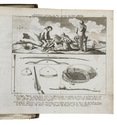
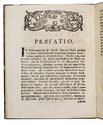
FRIBERG, Olavus and Olavus HERWECH. Q.B.V. Dissertatio academica, de constructione et usu mapparum hydrographicarum, quam consentiente ampliss. senatu philosoph. in regia academia Upsaliensi, publico eruditorum examini modeste submittunt auctor Olavus Friberg et respondens Olavus Herwech. ad. fil. Vermelandi, In auditorio Carolino Marjori die III. Maji Anno MDCCXLIV.
Uppsala, 1744. 4to. With 4 woodcut geometrical illustrations in the text, a large woodcut headpiece (with the words "constantia coronatur" in it) and one large woodcut decorated initial. Modern stiff (marbled?) paper boards with the title in gold on the spine. 16 pp. Full description
€ 750
Order Inquire Terms of sale

Battle of words over the best practical solution to the determination of longitude before Harrison's chronometer

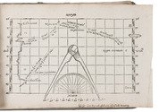
LEY, Jan Hendrick Jarichs van der. Het gulden zeeghel des grooten zeevaerts, daerinne beschreven wordt de waerachtige grondt vande zeylstreken en platte pas-caerten ...
Leeuwarden, Abraham vanden Rade, 1615. Oblong 4to (16.5 x 22 cm). With an emblematic engraved device/navigational diagram on the title-page and 27 (of 28) woodcut figures: 18 printed on integral leaves and the others on 3 folding plates. 18th-century(?) half vellum, blue-green paper sides, with manuscript author and title on spine. 114, [2] pp. Full description
€ 55,000
Order Inquire Terms of sale

First Latin edition of Linschoten's seminal guide to the East and West Indies, with 43 double-page and folding plates, including 7 maps

LINSCHOTEN, Jan Huygen van. Navigatio ac itinerarium Iohannis Hugonis Linscotani in Orientalem sive Lusitanorum Indiam...
The Hague, Aelbrecht Hendricksz, 1599.
With:
(2) [IDEM]. Descriptio totius Guineae Tractus, Congi, Angolae, et Monomotapae ...
Including:
- Historia trium navigationum Batavorum in septentrionem.
- Breviarium seu elenchus omnium redituum, canonum ...
The Hague, Aelbert Hendricksz., 1599.

2 works in 1 volume, the second in 3 parts. Folio (31 x 20 cm). With 2 typographical title-pages, each with a large engraved vignette of a ship, a full-page engraving of the dedicatee's coat-of-arms, a full-page engraved portrait of the author, 7 large folding engraved maps, 31 engraved double-page plates, and 5 large folding plates. Further with woodcut decorated initials. Contemporary overlapping vellum, sewn on 2 supports laced through the joints, blue edges. [2], [3], [portrait on p. [6]], 124, 45, [3] pp. Full description
€ 120,000
Order Inquire Terms of sale

Discovery of the Canary Islands in classical Greek and Roman, Arabic and Portuguese sources

MACEDO, Joaquim José da Costa de. Memoria em que se pertende provar que os Arabes não conhecerão as Canarias antes dos Portuguezes.
Lisbon, printing office of the Academia Real das Sciencias, 1844. Folio. With a woodcut Portuguese coat of arms on the title-page. Modern brown paper wrapper. [4], 232 pp. Full description
€ 1,500
Order Inquire Terms of sale

First edition of a report - with the rare folding map - from Commodore Perrys expedition containing directions for U.S. merchant ships navigating the coasts of China and Japan

MAURY, William Lewis & Silas BENT. Sailing directions and nautical remarks; by officers of the late U.S. naval expedition to Japan, under the command of Commodore M.C. Perry.
Including (with a divisional title): Fac-simile of the original treaty with Japan, with the English version.
Washington, A.O.P. Nicholson, public printer, 1857. Large 4to (ca. 29.5 x 23 cm). With a large folding map of the coast of China and of the Japanese and other islands, including the Marianas and the Philippines; and the facsimile of the 14-page treaty in Japanese printed on both sides of 7 integral leaves, with the English text printed letterpress on both sides of the following leaf. Original publishers half purple cloth, Spanish-marbled paper sides (grey with red, blue, black, yellow and white veins), letterpress paper label with the title in a built-up decorative border on the front board: "Sailing directions for the coasts of Japan and China". 22, [2], 14, [2] pp. Full description
€ 5,000
Order Inquire Terms of sale

The climate of the East African coast

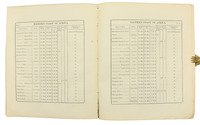
[ARABIAN GULF]. Weather in the Indian Ocean to Latitude 30° S. and Longitude 95° E. Including the Red Sea and Persian Gulf. Volume II. Local information. Part 9 Coast of East Africa from the equator to Cape Delgado [...].
London, Meteorological Office, Air Ministry, 1940. 8vo. With map frontispiece and several illustrations and tables in the text. Original publisher's printed red wrappers. 63 pp., final blank page. Full description
€ 1,500
Order Inquire Terms of sale

Highly detailed maritime atlas

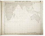
GREAT BRITAIN METEOROLOGICAL OFFICE. Monthly current charts for the Indian Ocean. From information collated & prepared in the Meteorological Office.
London, Admiralty Hydrographic Office, under the superintendence of Rear-Admiral W. J. L. Wharton, 1895-1896. Plano. Oblong Royal 1mo (full-sheet leaves: 51 x 62 cm). An atlas of 12 large black and white nautical charts. Limp cloth with gold-tooled title on front cover. [12] ll. plus the 1-page “Advertisement”. Full description
€ 3,500
Order Inquire Terms of sale

Probably the first manual for the use of chronometers at sea

OWEN, William Fitzwilliam (ed.) & Richard OWEN. Tables of latitudes, and longitudes by chronometer, of places in the Atlantic and Indian Oceans; principally of the west and east coast of Africa, the coasts of Arabia, Madagascar. &c. resulting from the observations of H.M.S. Leven and Barracouta, in the years 1820 to 1826 inclusive, ... To which is prefixed an essay on the management and use of chronometers ...
London, George Duckworth and William Ireland, 1827. 4to. Contemporary blue boards for the Danish Navy Library, later backed with cloth. [2], 33, [3], 16, [36], 8 pp Full description
€ 2,500
Order Inquire Terms of sale

Portuguese classic of practical navigation, with 36 maps and nautical charts

PIMENTEL, Manuel. Arte de navegar, em que se ensinão as regras praticas, e os modos de cartear, e de graduar a Balestilha por via de numeros, e muitos problemas uteis aì navegação, e roteiro das viagens, e costas maritimas de Guineì, Angola, Brazil, Indias, e Ilhas Occidentaes, e Orientaes ...
Lisbon, Miguel Manescal da Costa, 1762. Folio (30 x 20.5 cm). With 21 engraved plates (1 folding), 1 nearly full-page engraving of a compass rose and about 10 woodcut diagrams in the text. Contemporary or near contemporary tanned sheepskin, richly gold-tooled spine, new endpapers. [12], 603, [1] pp. Full description
€ 5,000
Order Inquire Terms of sale

Only published edition of the original 1521 text of the navigation book of the great Ottoman admiral

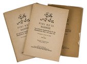
PIRI REIS (Paul KAHLE, ed.). Bahrije. Das türkische Segelhandbuch für das Mittelländische Meer vom Jahre 1521.
Berlin and Leipzig, Walter de Gruyter & Co., 1926-1927. 3 volumes. Large 8vo (26 x 18 cm). Volume 1 with 137 reproductions of manuscript pages of Ottoman Turkish text and maps and volume 2 with 4 plates. Publisher's original printed wrappers. [1], [1 blank], [2] pp. + 64 ll. + [4], [1 blank], [1] pp.; ll. 65-137; [1], [1 blank], XLVIII, 88 pp. Full description
€ 2,500
Order Inquire Terms of sale

Navigational guide covering the coast and coastal waters of Brazil, by the French Imprimerie Royale

ROUSSIN, Albin-Reine. Le pilote du Brésil, ou description des côtes de l'Amérique Méridionale comprises entre l'ile Santa-Catharina et celle de Maranaõ, avec les instructions nécessaires pour atterrir et naviguer sur ces côtes; ...
Paris, Imprimerie Royale, 1827. 8vo. Modern half calf, marbled sides. [3], [1 blank], 241, [1 blank] pp. Full description
€ 1,950
Order Inquire Terms of sale

Finely executed Royal Naval Academy exercises by the teenage future Admiral,
Charles Sotheby 493 pages including nautical charts, fortification plans,
astronomical diagrams, topographic views, etc.:

SOTHEBY, Charles. [engraved title-page:] A plan of mathematical learning taught in the Royal Academy Portsmouth performed by [in pencil: Charles Sotheby] a student there.
[Portsmouth], "177 " [recté 1795-1798]. 2 volumes. Imperial 4to (37.5 x 27 cm). Manuscript school exercises with a pre-printed engraved title-page with a blank space for the student to add his name, with 4 full-page and 1 larger folding nautical charts (some partly in colour), 7 full-page fortification plans (in black ink with 1 to 3 colours), 4 full-page astronomical diagrams (2 also with yellow), a full-page compass rose, 23 pen and ink wash views in the text (9 x 15 cm to 12.5 x 22 cm, 1 also with blue washes), and numerous other diagrams (including maps in the surveying section) and some illustrations in the text. Near contemporary (ca. 1803) blind- and gold-tooled half calf, blue sprinkled edges. engraved title-page + “229” [= 228]; 230-493, [2 blank] pp., with pp. 229 and 493 blank excepting the page numbers. Full description
€ 25,000
Order Inquire Terms of sale

Famous Dutch voyages of discovery, with 2 maps, 1 plan and 61 plates

[VOC - WIC]. Nederlandsche reizen, tot bevordering van den koophandel, na de meest afgelegene gewesten des aardkloots. ... Met plaaten. Eerste[-veertiende of laatste] deel.
Amsterdam, Peterus Conradi; Harlingen, W. van der Plaats, 1784-1787. 14 volumes bound as 6. 8vo. With 2 engraved folding maps, 1 engraved folding city plan and 61 engraved plates (56 folding) including many topographic views. Uniform half tree calf (ca. 1820?), gold-tooled spines. Full description
€ 9,500
Order Inquire Terms of sale

Manuscript course in the art of navigation, with figures in colour, including 2 volvelles

[NAVIGATION]. [VRIES, Klaas de, and others]. Schatkamer of konst der stuurlieden.
[Holland?], [ca. 1735/40?]. Folio (31.5 x 20.5 cm). A manuscript course in navigation written in brown ink on laid paper in a largely upright cursive hand, with 6 colour figures, including 2 volvelles, about 100 black and white diagrams, and numerous tables of data, highlighted with a yellow wash. Green paper wrappers (made from a discarded prospectus or the wrapper of an instalment of a book, [ca. 1865?]), later green cloth spine. [2 blank], 16, 19-109, [9 blank] pp. Full description
€ 18,000
Order Inquire Terms of sale
22 books books found / Show pages