Home
Shopping cart (0 items € 0)
Advanced search

Beautiful atlas of the Land van Voorne, in full contemporary colour
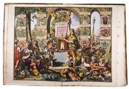
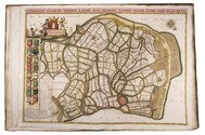
DIJCK (DYCK), Heyman van. Voorne caart-boeck van alle de dorpen, en polders gelegen inden lande van Oost, ende West Voorne, mitsgaders over Flacquée.
[Netherlands, ca. 1701]. Imperial folio (ca. 55 x 38 cm). Etched double-page title-page by Romeyn de Hooghe, dated "1701", and 32 engraved double-page maps (numbered I- VI, A-F and 1-9) engraved by Jan Stemmers and etched by Jan and Caspar Luyken after drawings by A. Steyaart, all in beautiful contemporary colouring. Contemporary red half sheepskin. Full description
€ 25,000
Order Inquire Terms of sale

Beautiful hand-coloured wall map of Rijnland

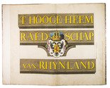
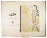
DOU, Jan Jansz. (Johannes Dou I), Steven van BROECKHUYSEN and Melchior BOLSTRA. 'T Hooge Heemraedschap van Rhynland.
[Amsterdam], Isaak Tirion, 1746. Atlas folio (58.5 x 37.3 cm). With 15 double-page engraved plates, all coloured by hand, including 13 maps. The plate size is mostly ca. 44.5 x 55 cm and ca. 41.5 x 55 cm, the map of the Haarlemmermeer has plate size 55 x 63 cm. An illustration of existing and projected sluices for drainage of the polder and another illustration with title, both after drawings by Melchior bolstra. All plates mounted on stubs so that they open flat. Half red sheepskin and intricately marbled paper sides. Full description
€ 6,000
Order Inquire Terms of sale

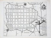
Beautiful wall map of Rijnland

DOU, Jan Jansz. (Johannes Dou I), Steven van BROECKHUYSEN and Melchior BOLSTRA. 'T Hooge Heemraedschap van Rhynland.
[Amsterdam], Isaak Tirion, 1746. Atlas folio (58.5 x 37.5 cm). With 15 double-page engraved plates (plate size mostly ca. 44.5 x 55 cm and ca. 41.5 x 55 cm), including 13 maps (that of the Haarlemmermeer with plate size 55 x 63 cm), an illustration of existing and projected sluices for drainage of the polder and another illustration with title, both after drawings by Melchior Bolstra. All plates mounted on stubs so that they open flat. Half calf. Full description
€ 5,000
Order Inquire Terms of sale

Topographical wall map of the Dutch (polder) district Vijfheerenlanden,
including the very rare engraved borders with coats of arms

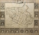
OTTENS, Reinier and Josua OTTENS. Nieuwe kaart van de Vyf Heeren landen gelegen tusschen den Dief en Zouwen dyk.
Amsterdam, Reinier and Josua Ottens, 1741. Engraved map on 4 sheets (85 x 98 cm as assembled), with an engraved title ("Kaart van de Vyf Heerenlanden") with the coat of arms of the water district at the head, and surrounded by 14 engraved coats of arms at the left, right and foot (measuring 122 x 134 cm in total). The map with the title and publisher at the foot left, together with a scale (ca. 1:19,000) and the name of the engraver at the right (Jan van Jagen). Framed. Full description
€ 6,500
Order Inquire Terms of sale

New designs for a sluice and dredging machine, beautifully illustrated, presentation copy to Christiaan Brunings, inspector of the original design and writer of a preliminary text

REDELYKHEID, Cornelis. De nieuw uitgevonden sluis met in- en uitschuivende deuren.
With: (2) REDELYKHEID, Cornelis. De nieuw uitgevonden diep-machine.
The Hague, Hendrik Christoffel Gutteling; Amsterdam, Jacob Yntema & Jacob Tieboel; for the author, 1774. 2 works in 1 volume. Large folio (49.5 x 31 cm). Ad 1 with 6 large folding engraved plates and ad 2 with 3 large folding engraved plates. Contemporary half calf. XII, 26; XI, [1], 18 pp. Full description
€ 7,500
Order Inquire Terms of sale

Manuscript plan of the "Stelling Den Helder": the oldest surviving defence line in Dutch military history, including the important marine shipyard Willemsoord

[FORTIFICATION PLAN - DEN HELDER - WILLEMSOORD]. KRAG, Rasmus. Kort over en deel af provindsen Nordholland med befestningen af de Helder, maritime & etablissementet Willemsoort samt en deel af den nye Nordhollandske Canal.
[The Netherlands?], 1825. Double Elephant 1mo sheet (92 x 63 cm). With a pen and ink-drawn fortification plan (ca. 85 x 55 cm) of the Den Helder fortifications and the marine shipyard Willemsoord, coloured by a contemporary hand, with a manuscript title, scales and a key in Danish, written in a fine and legible 19th-century hand surrounding the plan. On Whatman wove paper. Folded. [1] sheet. Full description
€ 1,800
Order Inquire Terms of sale

Fine wall map coloured by a contemporary hand

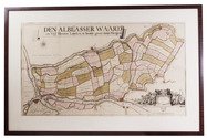
[MAP - NETHERLANDS - ALBLASSERWAARD]. ]. Den Alblasserwaard en Vyf Heeren Landen, te samen groot 33110. mergen. Nieuwe caerte vertoonende den geheelen Alblasserwaert. Nieuwlycx uytgegeven door Abel de Vries landmeter tot Dordrecht 1716. Met een nette aanwijzing der dijkbreuken en hulpgaten van 't jaar 1740 en 1741. uytgegeeven door Matth. de Vries.
[Dordrecht], Matthias de Vries, [ca. 1741]. 66 x 117 cm. Wall-map on 4 sheets, originally engraved by Bastiaan Stopendaal (1637-1693), in contemporary hand colouring. Framed (93 x 143 cm). Full description
€ 9,500
Order Inquire Terms of sale

Collection of 6 maps of the Beemster polder 1644-1979

[MAP - NETHERLANDS - BEEMSTER]. FLORISZ. VAN BERCKENRODE, Balthasar and Daniel van BREEN. Beemsterlants caerte... [with a second title at the head:] Ware afbeeldinge vande bedyckte Beemster-landen... M.DC.XLIIII.
Amsterdam, 1644 [reprinted ca. 1769?]. Engraved map in 6 sheets (each 56 x 44 cm).
With:
(2) [FLORISZ. VAN BERCKENRODE, Balthasar] and Daniel van BREEN. Beemsterlants caerte...
Amsterdam, 1658. Engraved map (43.5 x 58 cm).
(3) Beemster landts kaarte, aenwijsende de hoogte vande ringhdyck.
[Amsterdam(?), ca. 1696]. Engraved map (28 x 35.5 cm).
(4) DORLAND, C. [2 maps of the Beemster].
Amsterdam, Tresling & Co., March 1908. 2 nearly identical chromolithographed maps (ca. 28 x 36 cm), the first partly and the second wholly coloured.
(5) Waterschap de Beemster.
February 1970, updated to 1979. Large map (64 x 50 cm).
Collection of 6 maps (the first in 6 sheets). Bound in modern cloth (57.5 x 47 cm). Full description
€ 3,750
Order Inquire Terms of sale
12 books found / Show all