BRUÉ, Adrien Hubert.
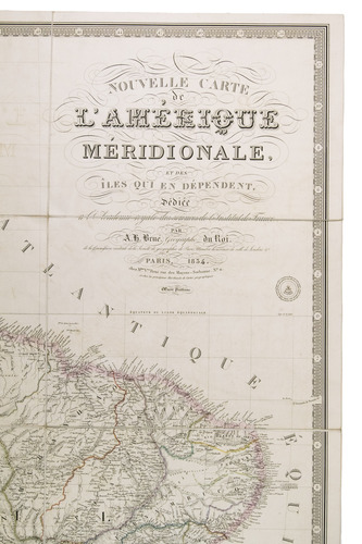
Nouvelle carte de l'Amerique meridionale, et des îles qui en dépendent ...
Paris, Mme Vve Brue, 1834-1835.
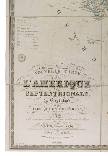
With: (2) BRUÉ, Adrien Hubert. Nouvelle carte de l'Amerique septentrionale, du Groënland et des îles qui en dépendent.
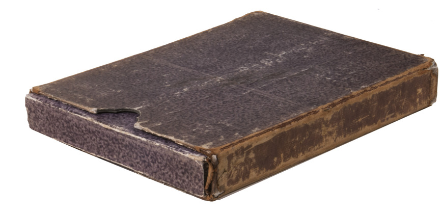
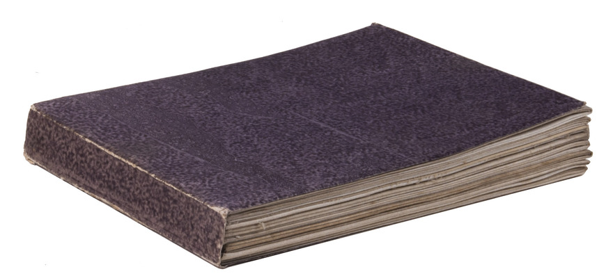
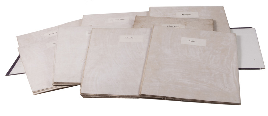
Paris, Charles Picquet, 1835. All maps ca. 93 x 65 cm. With 8 large, folding, cloth-backed maps. The maps are housed in a contemporary folder of purple paste paper, which is housed in contemporary slipcase of gold-tooled brown calf on the edges, with the author and title lettered in gold on the spine, and purple paste paper sides. [8] maps.
€ 8,500
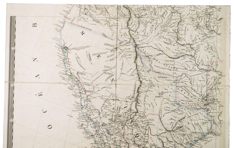
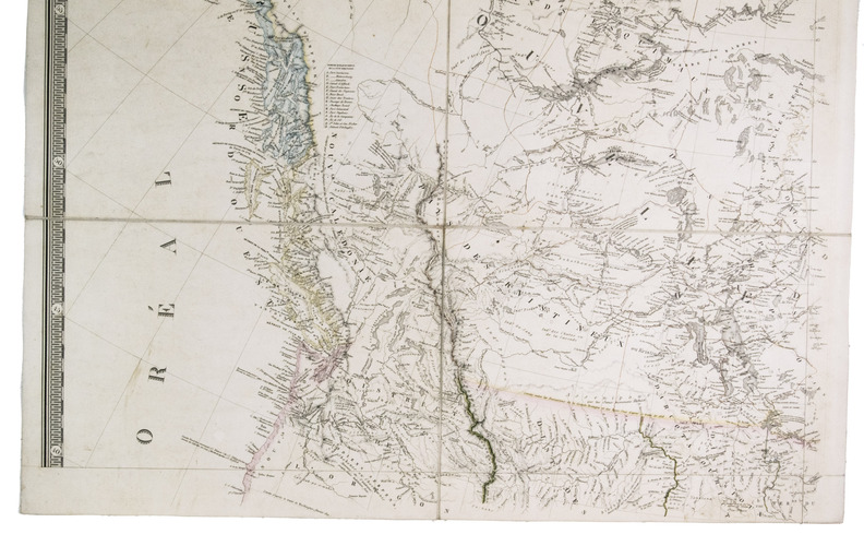
First edition of a very large map of North and South America, published as two separate works. The maps show the latest political developments in the continents, and also clearly mark the parts that had not yet been mapped, including a large region on the border of Peru and Brazil, as well as a portion of what was then the north of Mexico. First editions of the two works are quite rare, and it is even more remarkable to find the them together. We have not been able to find them together in any sales records of the past hundred years.
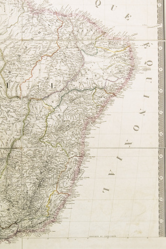
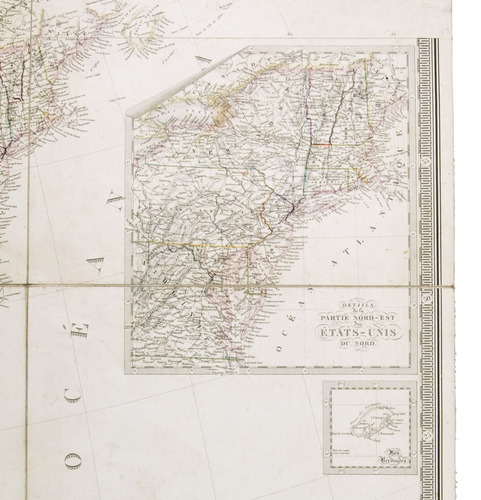
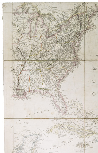
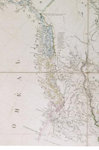
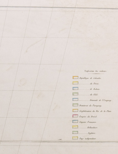
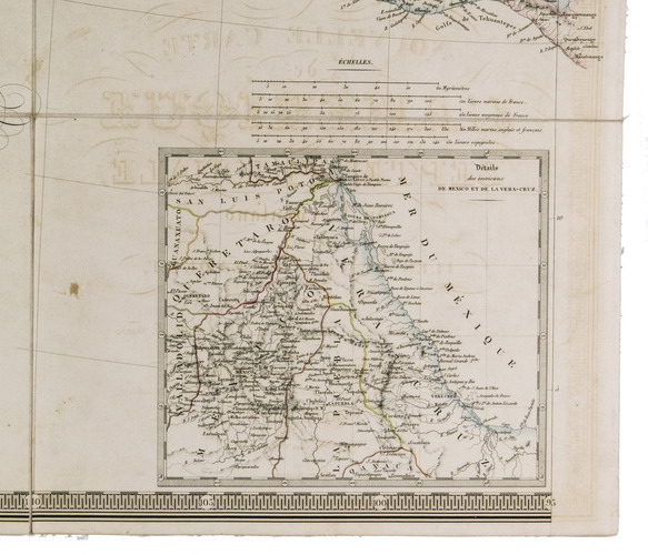
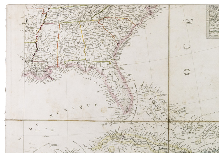
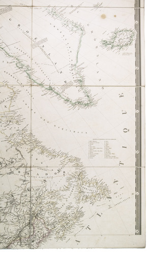
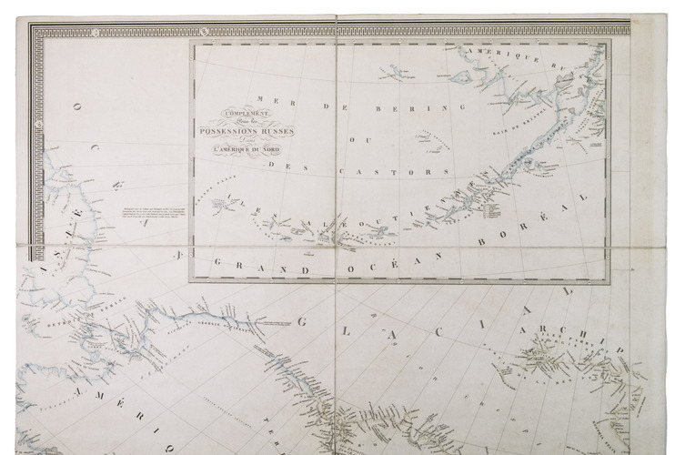
The work is divided in eight folding, cloth-backed maps. The ones labeled Brésil, Colombie, Rio de la Plata and Uruguay, together form a very large map of South America (Amerique meridionale). The other four maps form the map of North and Middle America (Amerique septentrionale). The maps were drawn before the Texas Revolution (1835-1836), as Texas is here still a part of Mexico. The map of North America also likely shows the very beginning of the Trail of Tears (1830-1850), which was the forced displacement of thousands of Native Americans from the southeast to a new territory west of the Mississippi River. The Choctaw, the first Nation to be removed, can be found on the map in both the old and new location, while the other four Nations (Cherokee, Chickasaw, Muscogee, and Seminole) are still mostly in the southeast.
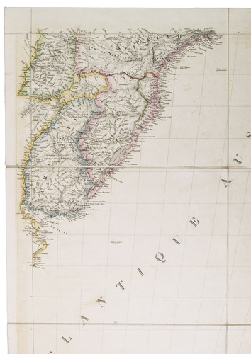
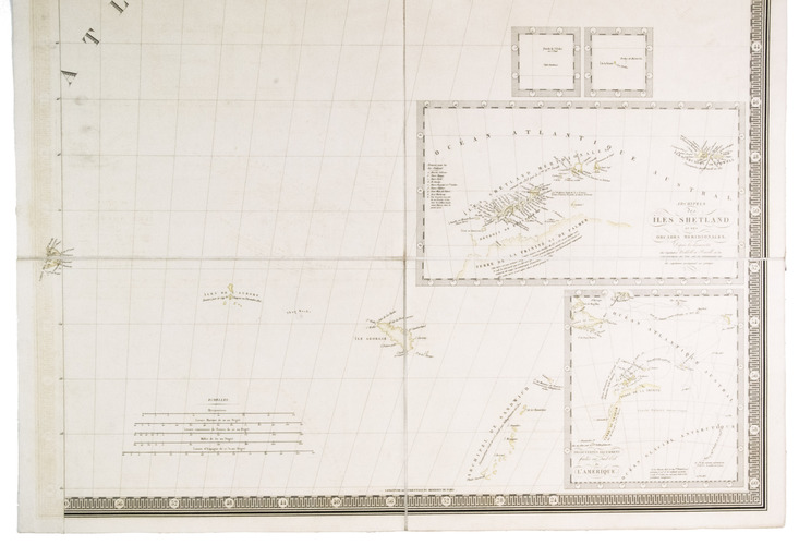
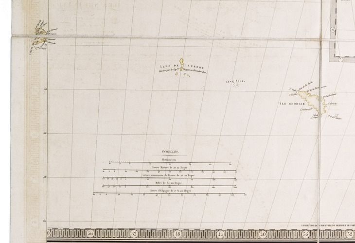
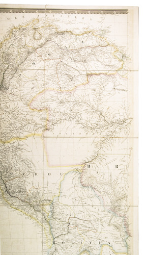
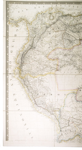
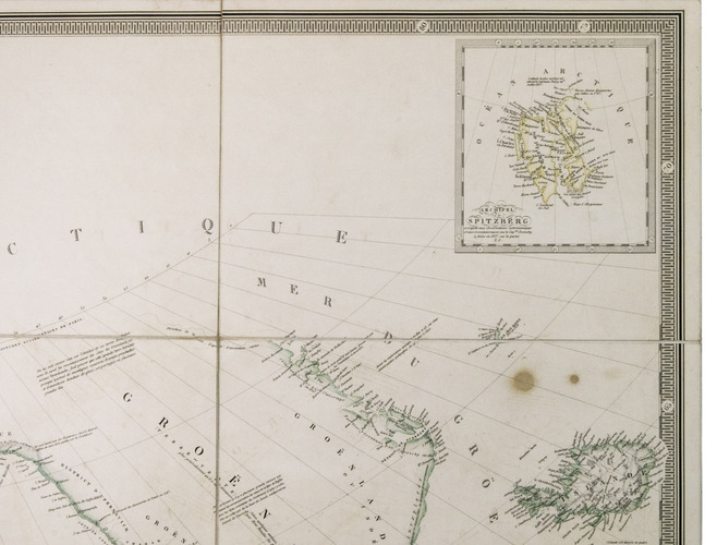
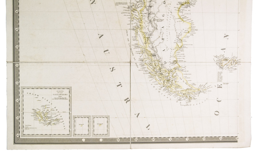
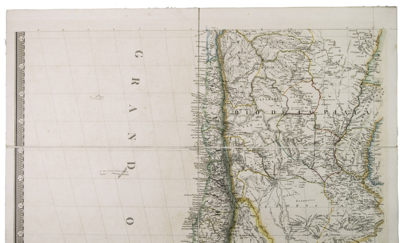
The map of South America also shows interesting developments. This is particularly the case in the northern part of the continent where Peru, Brazil, Bolivia, Colombia and Venezuela were establishing their borders. Although it was dissolved in 1830, the short lived region previously known as Gran Colombia is prominent on this map. The Atacama desert, which was the subject of a border dispute between Chile and Bolivia (1825-1879), is still drawn as Bolivian territory on the map, although it is now part of Chile. There are also multiple insets, including new South Polar discoveries and the Galapagos.
With a small, white, round sticker mounted on the map of Brasil ("Propriété de l'auteur") and the map of Mexico ("Propriété acquise en 1835"), all maps with a handwritten paper label mounted on the back, with the name of the country it shows. The map labeled "Mexique" is somewhat browned and stained (primarily on the back), the other maps are very lightly browned and stained. The edges and corners of the slipcase are scuffed, with some loss of material in the corners, the paste paper has discoloured from past sunlight. Otherwise in good condition. Ad 1: Phillips, P. L., A list of maps of America, p. 601 (year of publication misread as 1833); WorldCat 431298691, 494185499, 1389168347, 1389149780 (4 copies); Cf. Sabin 8735 (later ed.). Ad 2: WorldCat 466241697, 60460799 (2 copies).
Related Subjects: