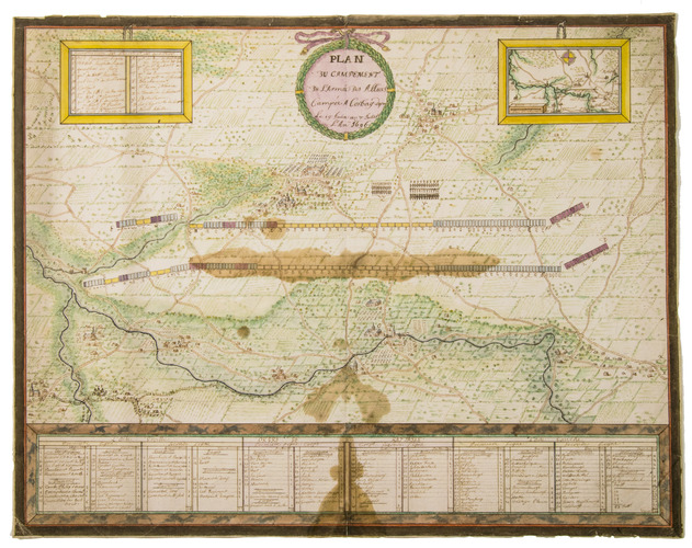
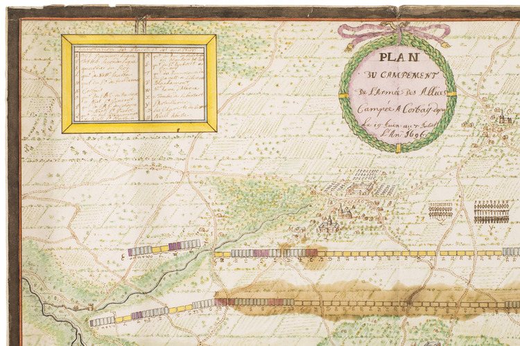
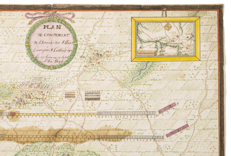
[MAP - MILITARY - LOW COUNTRIES - KORBEEK].
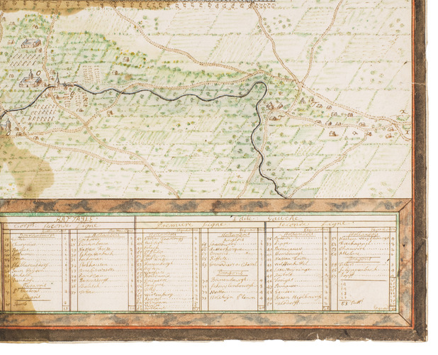
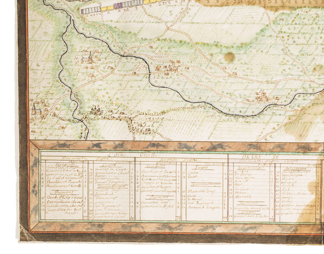
Plan du campement de l'armée des alliees campée a Corbay depuis le 19 Juin au 7 Juliet l'an 1696.
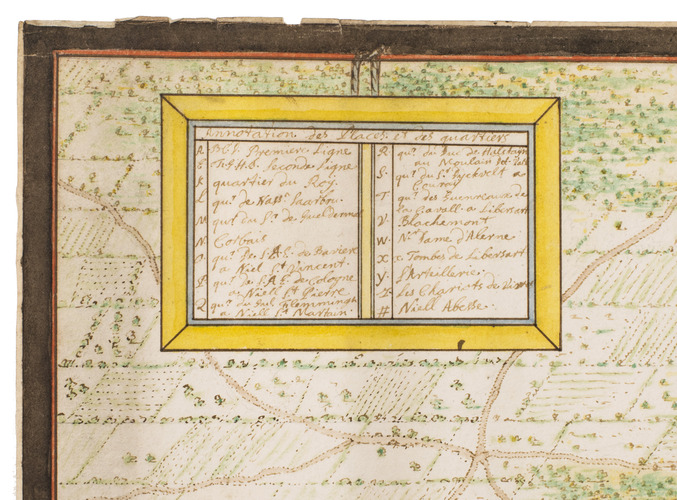
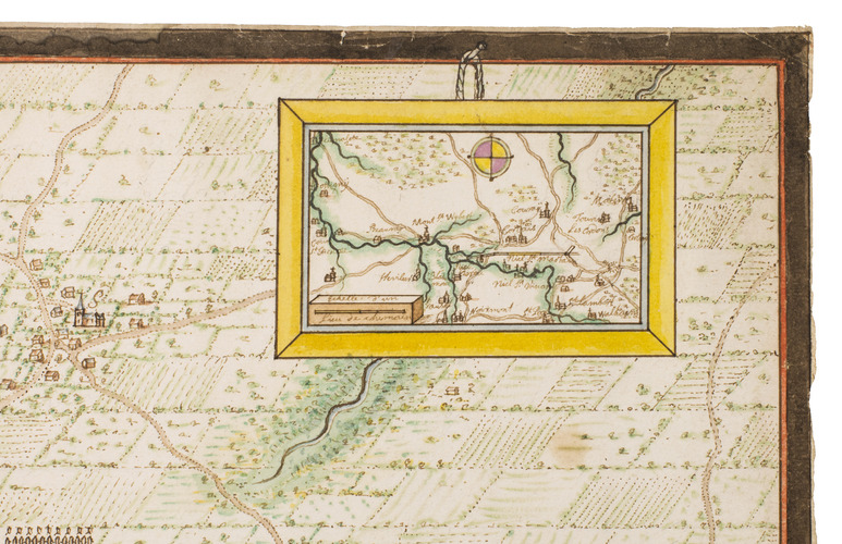
[Belgium?, ca. 1696]. Manuscript plan on paper (38 x 48 cm) in ink and bright watercolour. With the title in a wreath at the head, a large panel at the foot with keys identifying the camps of the various troops, and two smaller panels at the head, with keys to the villages and other locations, and a general overview map.
€ 2,000
Contemporary manuscript plan of the camps of the allied troops fighting against France during the Nine Years' War, in the vicinity of Korbeek (Corbais), near Waver, Belgium, between 19 June and 7 July 1696. These troops were part of the Grand Alliance, the European-wide coalition that fought against Louis XIV during the Nine Years' War (1688-1697). The present map shows mostly Dutch and German, but also Spanish troops. The Dutch forces include troops led by well-known commanders as Menno van Coehoorn, Johan van Baer van Slangenburg and Lodewijk Crato van Nassau-Saarbrücken.
The map is drawn on paper watermarked: fleur-de-lis on a crowned shield above WR = IHS DC (?), similar watermarks all date from the last decades of the 17th-century (cf. Heawood 1780, 1785 and 1787).
A few minor tears along the edges and some brown water stains. Nevertheless, the plan remains clearly legible and the colouring remains bright.
Related Subjects: