[HASE, Johann Matthias].
Plans des villes que passent pour les plus grandes de l'antiquité, et de nos jours ...
Nuremberg, Homann heirs, 1745. Folio. With 15 hand coloured, numbered, engraved plates. Modern folder, marbled paper over boards. Each leaf (ca. 56 x 66 cm) is separately mounted in a passe-partout (ca. 60 x 78 cm). [8] ll.
€ 2,500
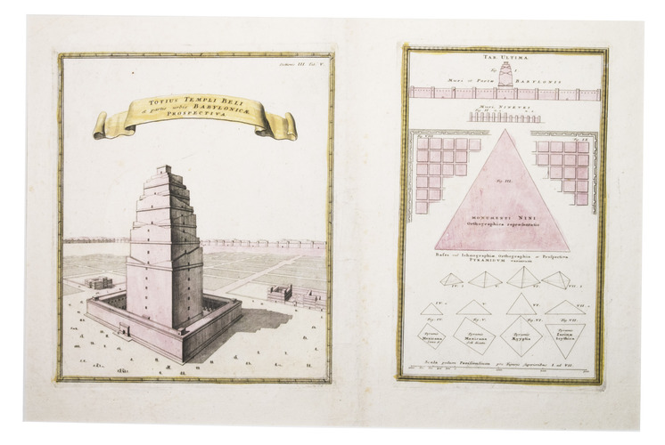
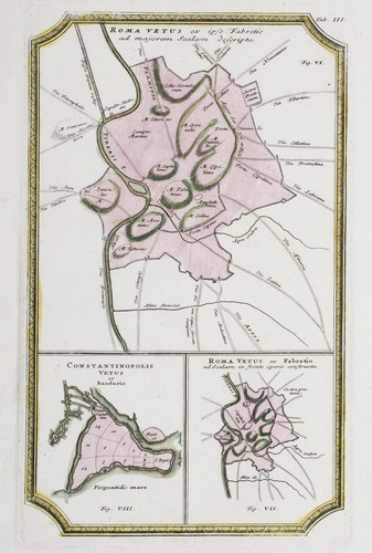
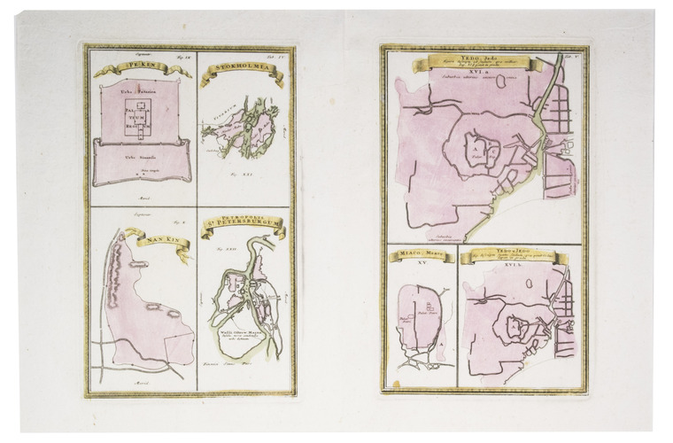
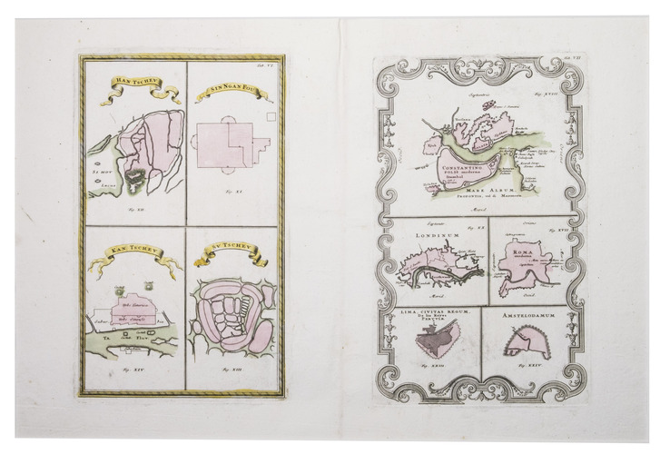
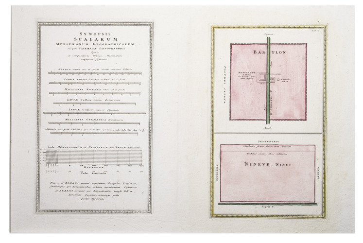
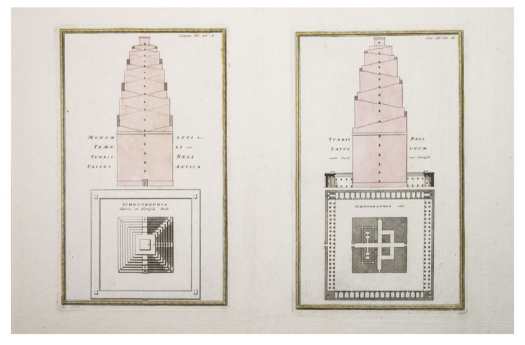
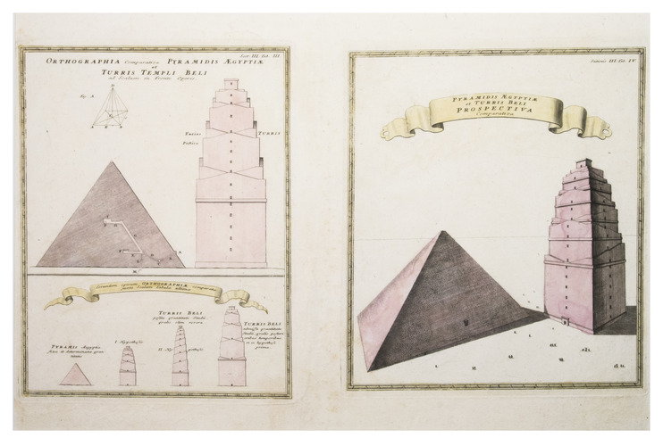
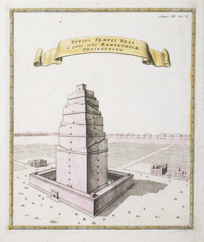
First edition of an exceptionally rare, complete collection, containing plans of the most important cities and buildings from antiquity. The plans were based on the most recent historical research of the time, so the depicted sizes were as accurate as they could have been. Especially charming are the plates which compare the height of the tower of Babylon with that of Egyptian pyramids. This collection is exceptionally rare, as we have only been able to find two other copies worldwide.
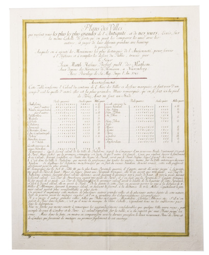
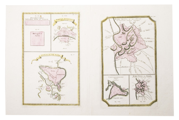
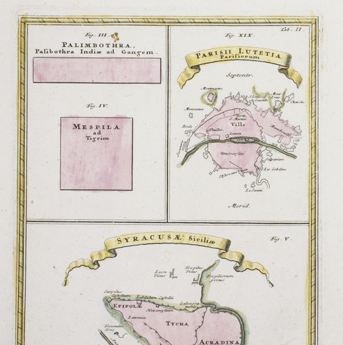
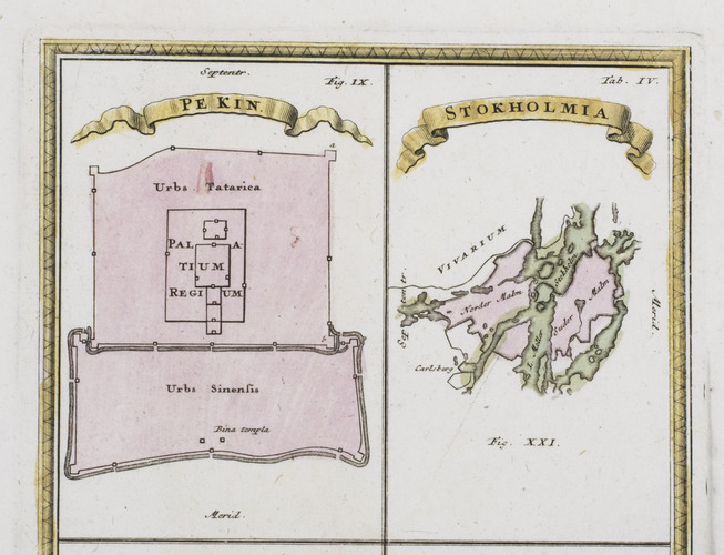
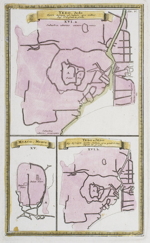
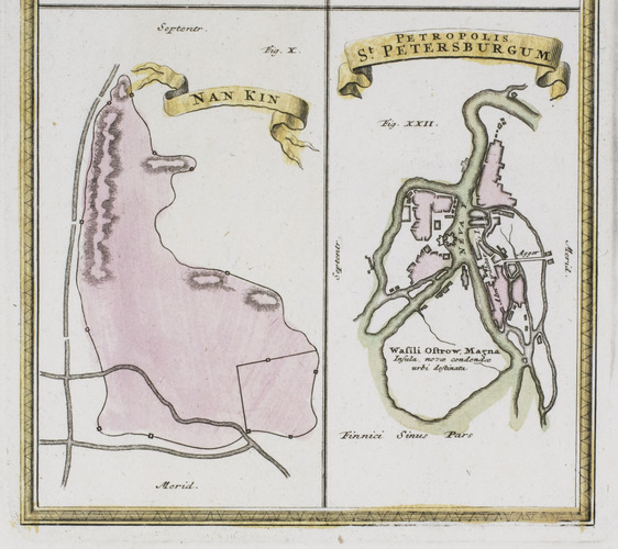
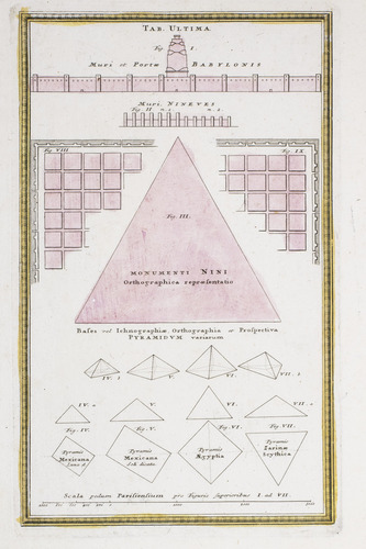
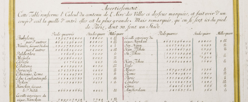
The plates depict the plans of some of the most important 18th-century cities, including Paris, London, Amsterdam, Lima, Nanjing and Tokyo, and compare them to the most important cities from antiquity, including Rome, Constantinople, Babylon and Nineveh. All plans are drawn on the same scale.
Johann Matthias Hase (1684-1742) was a German mathematician, cartographer and historical geographer. He is often lauded for the scientific accuracy of his work. According to Goffart, "he [Hase] practiced cartography as the scientific equal of Delisle and d'Anville" [Guillaume Delisle (1675-1726) and Jean-Baptiste Bourguignon d'Anville (1697-1782)]. The plans in the present series were based on the most recent, up-to-date information. They were published posthumously, but it is known that Hase worked on them for many years before his death.
Other than historical city plans, Hase also worked on maps of historical countries. All his historical cartography was published in 6 different collections between 1743 and 1746, in Latin, French and German. In 1750, all 6 collections were combined into one work, the Atlas historicus, which showed the empires of the world as they evolved throughout history. The collection of historical city plans was the 6th and final part. The present copy, however, was never a part of the atlas, as it has no sewing holes. It is the true first edition, published 5 years earlier as a plate collection.
Historical atlases like the one by Hase have existed since the 16th century. However, the first work to be called a "historical atlas" was published between 1705-1730 in Amsterdam, likely by Zacharias Châtelain. The term took off and numerous historical atlases were published in the 18th century. However, many of these atlases were based on the Bible or maps by Ptolemy. There were only a few cartographers, including Delisle, d'Anville, and Hase, who based their maps on other historical documents, making them far more accurate. In addition, whereas earlier cartographers usually just made one map of an antique empire, Hase made multiple. He was aware of the fact that the borders of past empires were not fixed and therefore made maps for different time periods. He was the very first to draw a map of the Roman empire under Emperor Justinian I (482/483-565), for example. As such, he was one of the first to show how empires changed throughout history, making his historical atlas an incredibly important cartographical work.
All plates are folded down the middle, as issued. Some of the plates have small ink stains in the margins. Overall in very good condition.
Related Subjects: